Searching for Garrett's Arch
Explore Landscapes #77
What was supposed to be 'a walk in the park' turned into quite the adventure last weekend following a last-minute change of plan to hike off-trail into the Wonderland of Rocks.
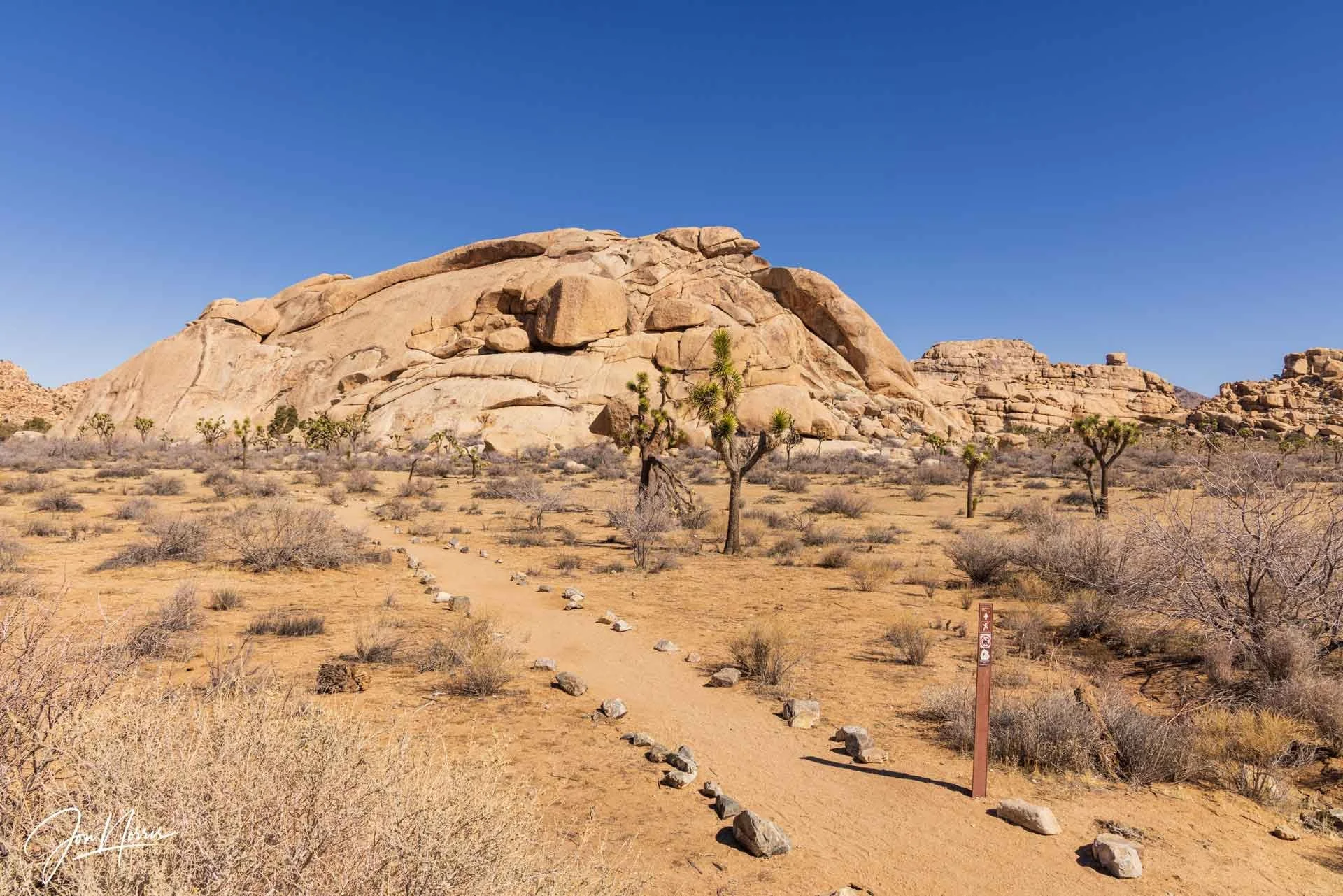
Echo Rock | © 2025 Jon Norris
Last weekend, I spent four days in Joshua Tree, which was fantastic and (as I was off-grid for the majority of the time) a much-needed break from reading about the chaos caused by the current administration.
I have a 5-mile photo hike that I enjoy that connects several different trails and by and large keeps you away from the most crowded areas of the park.
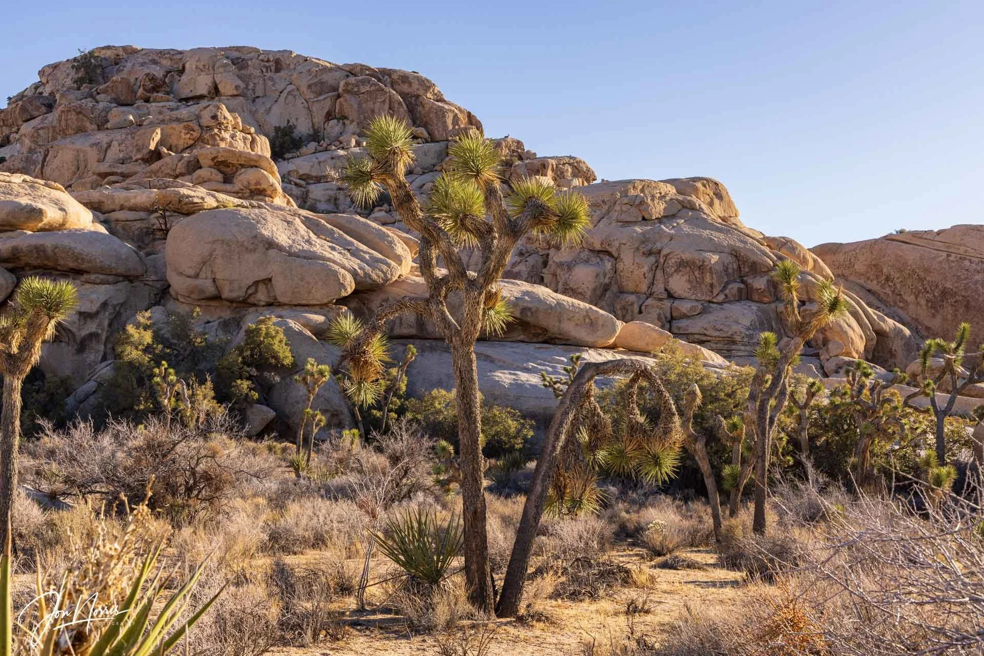
The climbing community has named many of the rock features in the park. It’s fun to get to know the creative names they come up with for each of the ‘inselbergs’ and/or climbing areas. I parked the truck at the Echo T trailhead, ensured I had plenty of water and snacks in my pack, and headed towards Echo Rock on a well-maintained rock-lined trail (thanks to the all the hard work of the NPS team at Joshua Tree).
NOTE: I’m outraged by what is happening to our public lands.
If you’re planning a trip to a National Park this year, PLEASE look up their nonprofit partner and consider signing up for a volunteer project or educational program.
Alternatively, please consider purchasing from one of the park stores (also run by the non-profit partners). That money (and/or your volunteer hours) directly support our parks and those experiences enrich your connection to the landscapes you visit.
The non-profit partner at Joshua Tree National Park is the Joshua Tree National Park Association. To find who’s supporting your favorite park(s), search for ‘nonprofit partner’ and the name of your park.
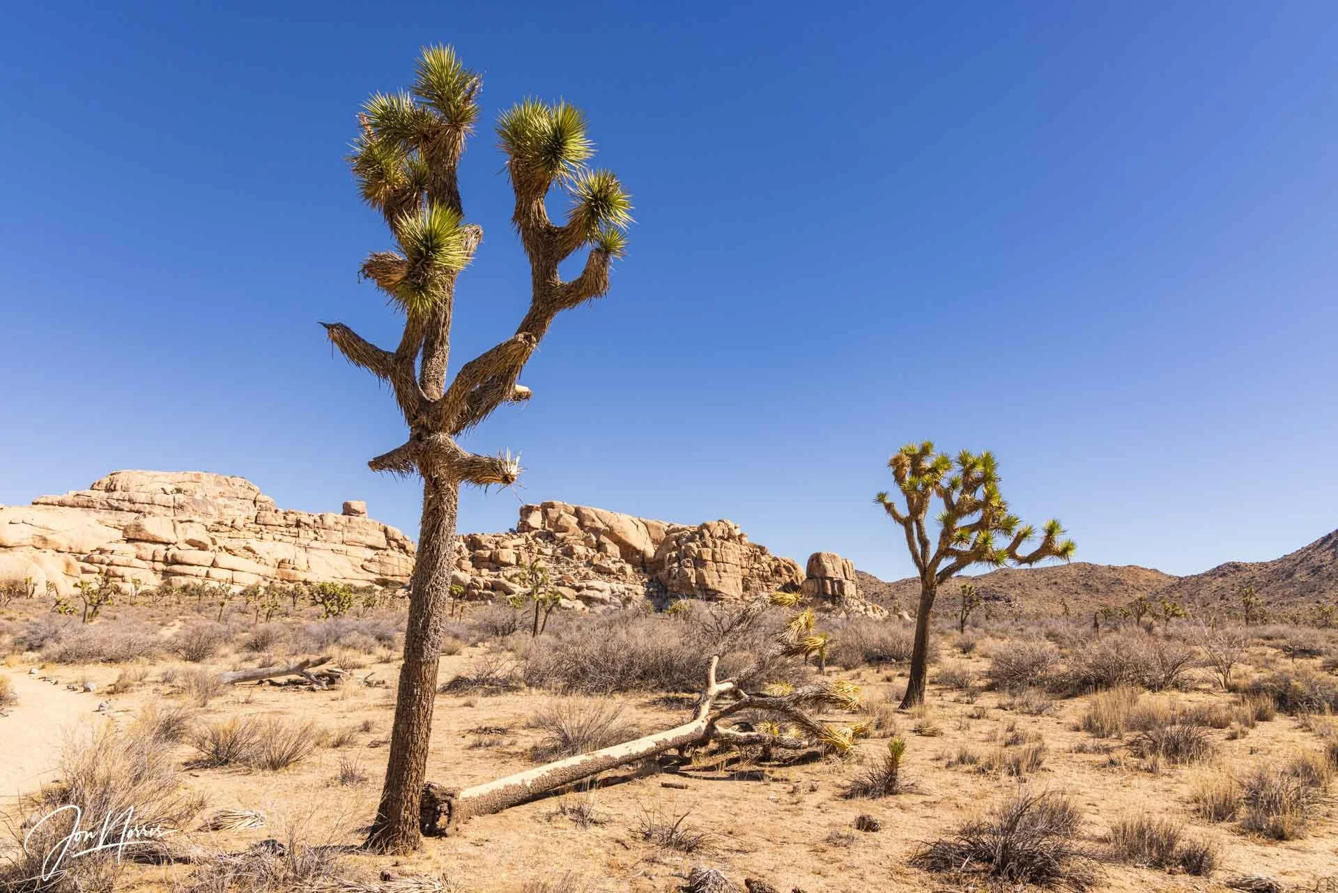
Snickers | © 2025 Jon Norris
The Echo T Trail is an easy trail, with minimal elevation gain (38 ft / 12 m), and is a mix of compact dirt, granite boulders, and sandy washes. The trail turns away from Echo Rock and passes Snickers before a little easy scrambling up a granite step brings you to the Barker Dam Nature Trail.
It was a perfect day for hiking in the desert. It was in the mid-60s, with a very light breeze and a bluebird sky. I stopped every few hundred yards to take the scene in and photograph whatever I found along the way.
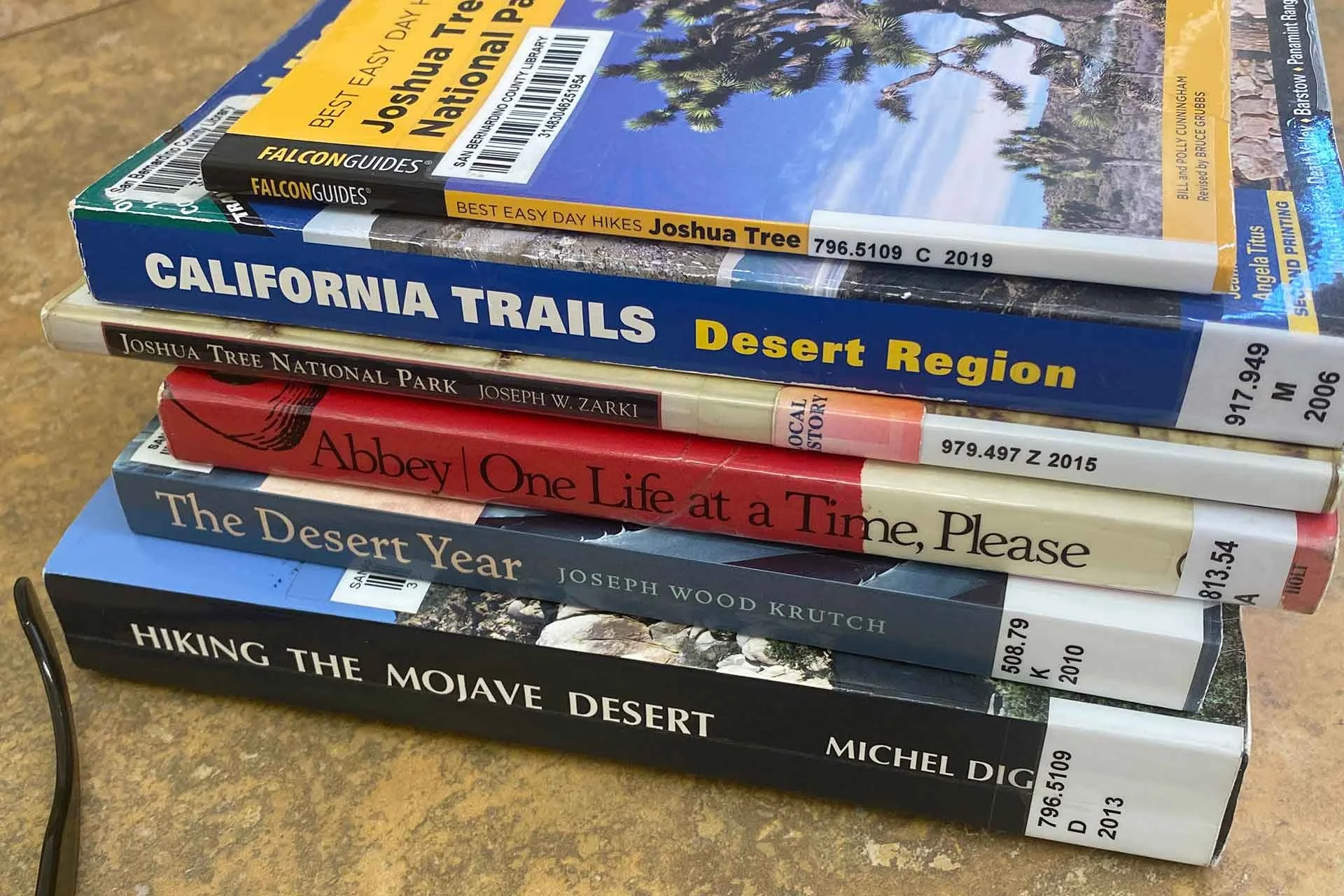
A fine selection of books found in the Joshua Tree library | © 2025 Jon Norris
The day before my hike, I’d spent the morning and lunchtime with my friends (aka my desert family) from the JTNPA Desert Institute for our 2025 Instructor and Volunteer orientation meeting. Our Spring classes have just started, and there are so many great courses to sign up for. Please go and take a look at the Spring 2025 Class Field Guide.
I was excited for the season ahead, wondering what I could do for a few hours in the afternoon before heading to my campsite for the night. I found myself in downtown Joshua Tree needing a coffee (after a delicious lunch laid on by the DI), which meant a visit to Joshua Tree Coffee and a 16oz Americano.
As I returned to my truck, I noticed the Joshua Tree branch library, which I had never visited before. I think the universe had aligned to get me into the library that day. Before I knew it I had become a proud San Bernardino County Library member (with my very own library card) and had a stack of books to read.
One of those books inspired me to modify my route and hike off-trail into the Wonderland of Rocks.
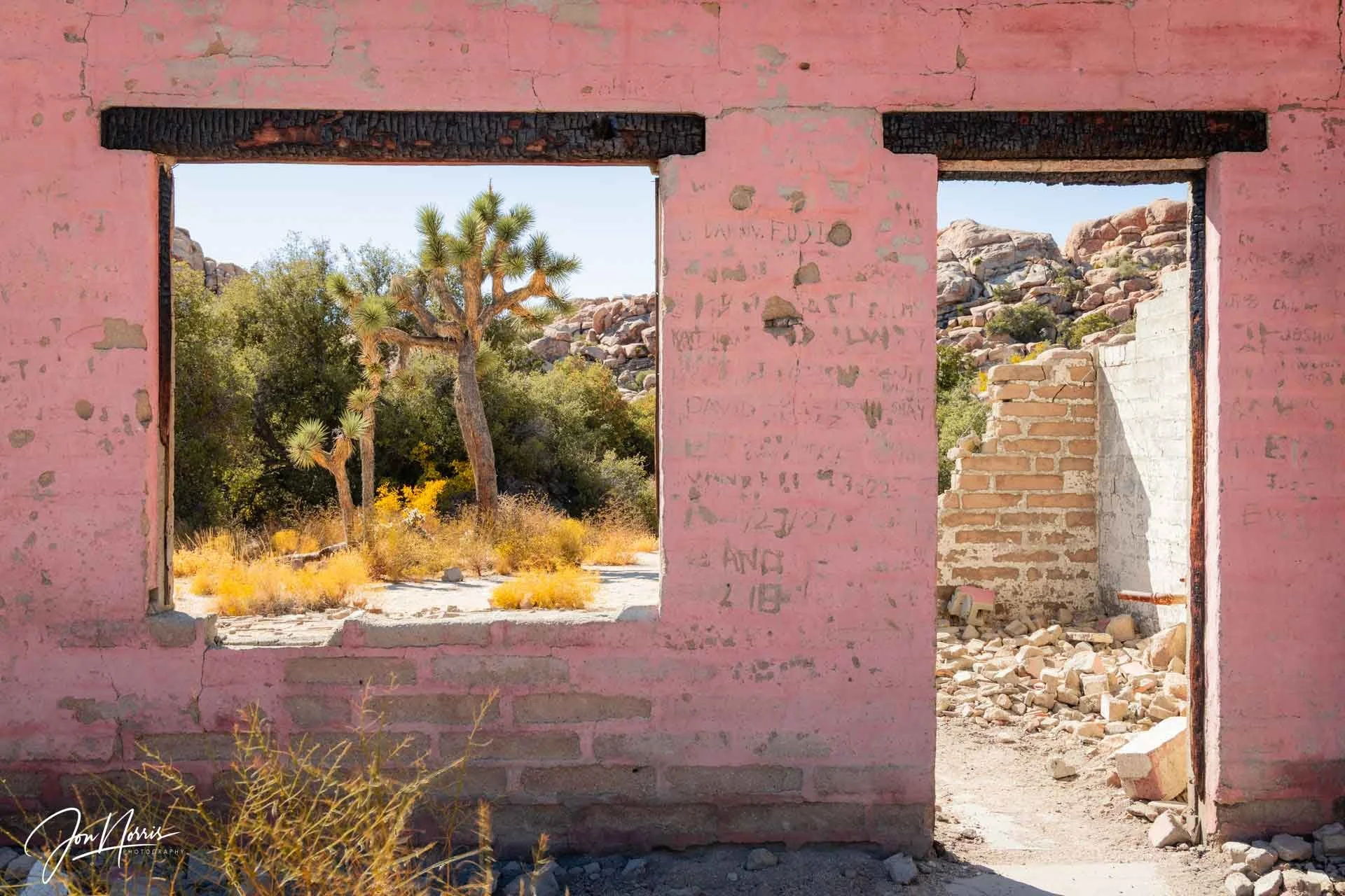
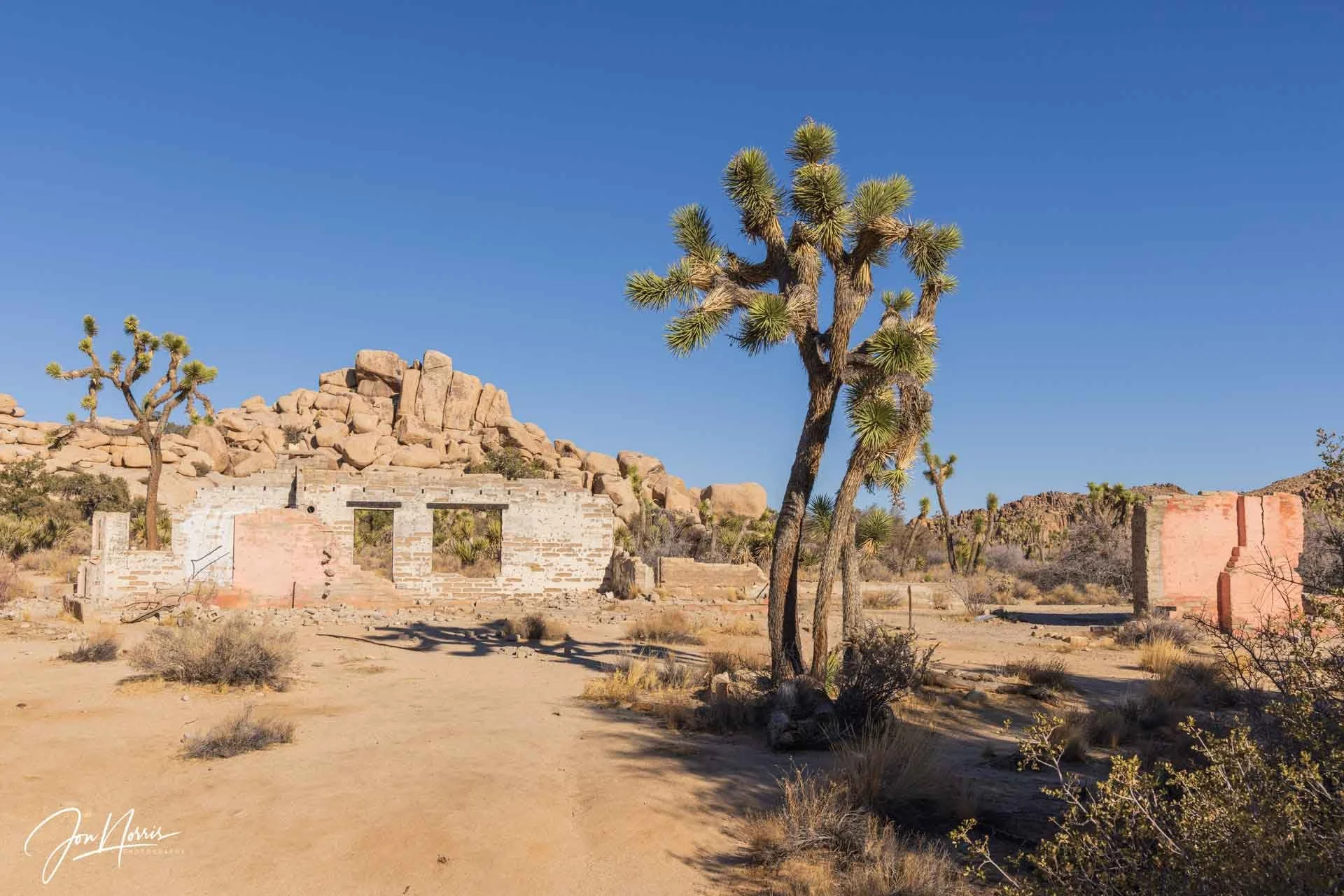
Wonderland Ranch | © 2025 Jon Norris
The original route of my hike took me to Wonderland Ranch. Now in ruins, the pink walls of this ranch and the associated artefacts surrounding the site provide a fascinating look into what life must have been like for those settlers who called this place home.
As soon as I saw the familiar pink walls, I had a lightbulb moment. Why don’t I change course and explore the Wonderland of Rocks? The cogs were turning. Maybe I could find Garrett’s Arch, a granite rock feature that I’d been reading about. It’s not shown on any maps, but I had a reasonably good idea of where it was located based on my reading.
Just behind the ranch is the start of the Wonderland of Rocks Wash hike. And that’s when my adventure started.
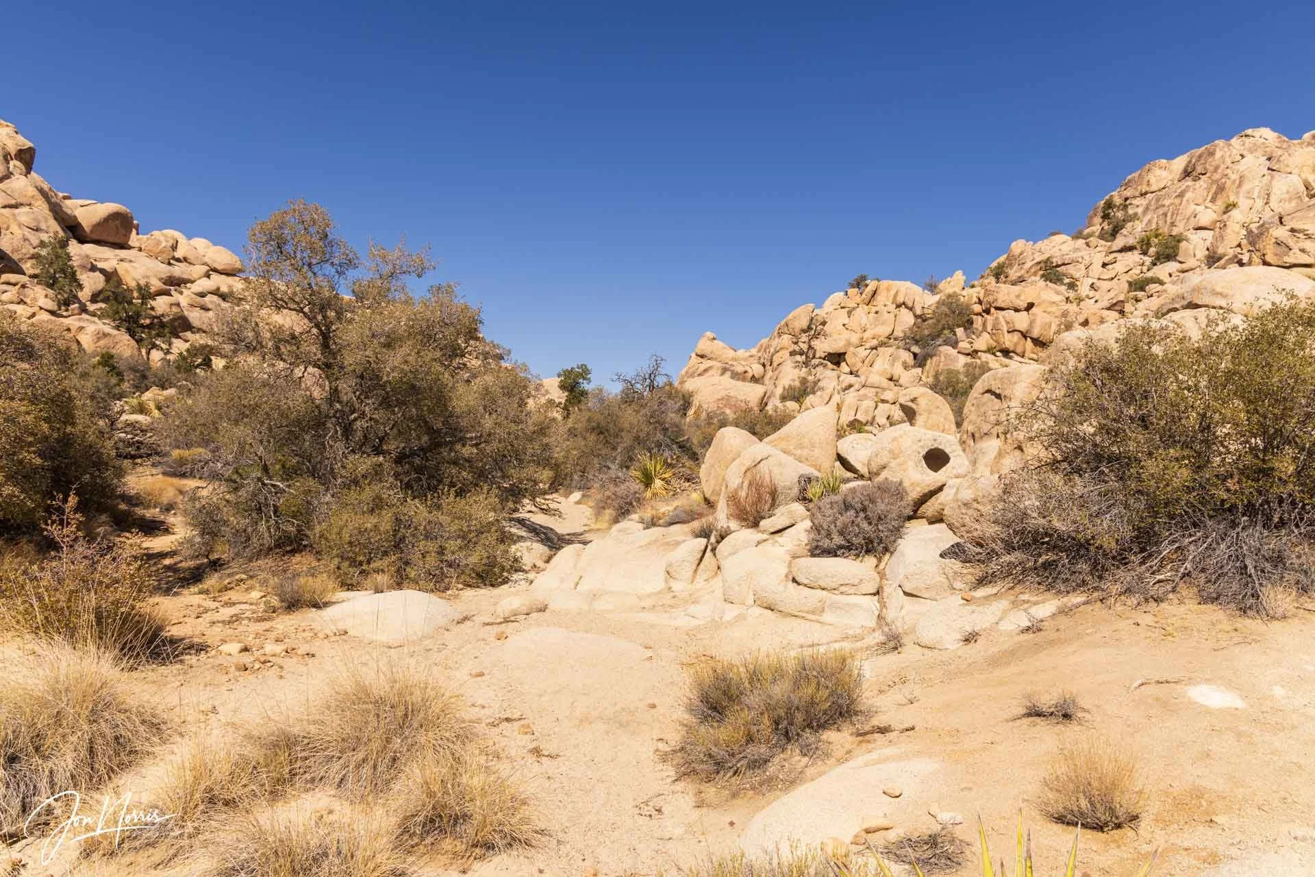
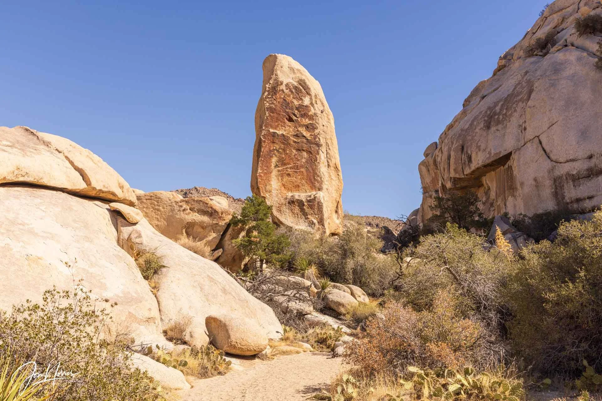
The entrance to The Wonderland of Rocks Wash hike | © 2025 Jon Norris
Caution: The Wonderland of Rocks Wash hike is a trail that I wouldn’t recommend for everyone, as it’s unmaintained, and although relatively well-traveled, it does not always follow a clear path, is often overgrown, and requires scrambling over large granite boulders.
Since it’s not a maintained trail, you should exercise an abundance of caution and be over-prepared. Make sure that you carry with you the 10 desert essentials.
Navigation in the Wonderland of Rocks is notoriously tricky. There is no cell service in Joshua Tree National Park so be sure to download a detailed topographical map ahead of time, and ensure you have a paper topographical map and compass with you (in case the battery on your phone dies).
Also, you are unlikely to see anyone else once inside the Wonderland of Rocks. I didn’t see a soul for the entire 4-5 hours I explored here.
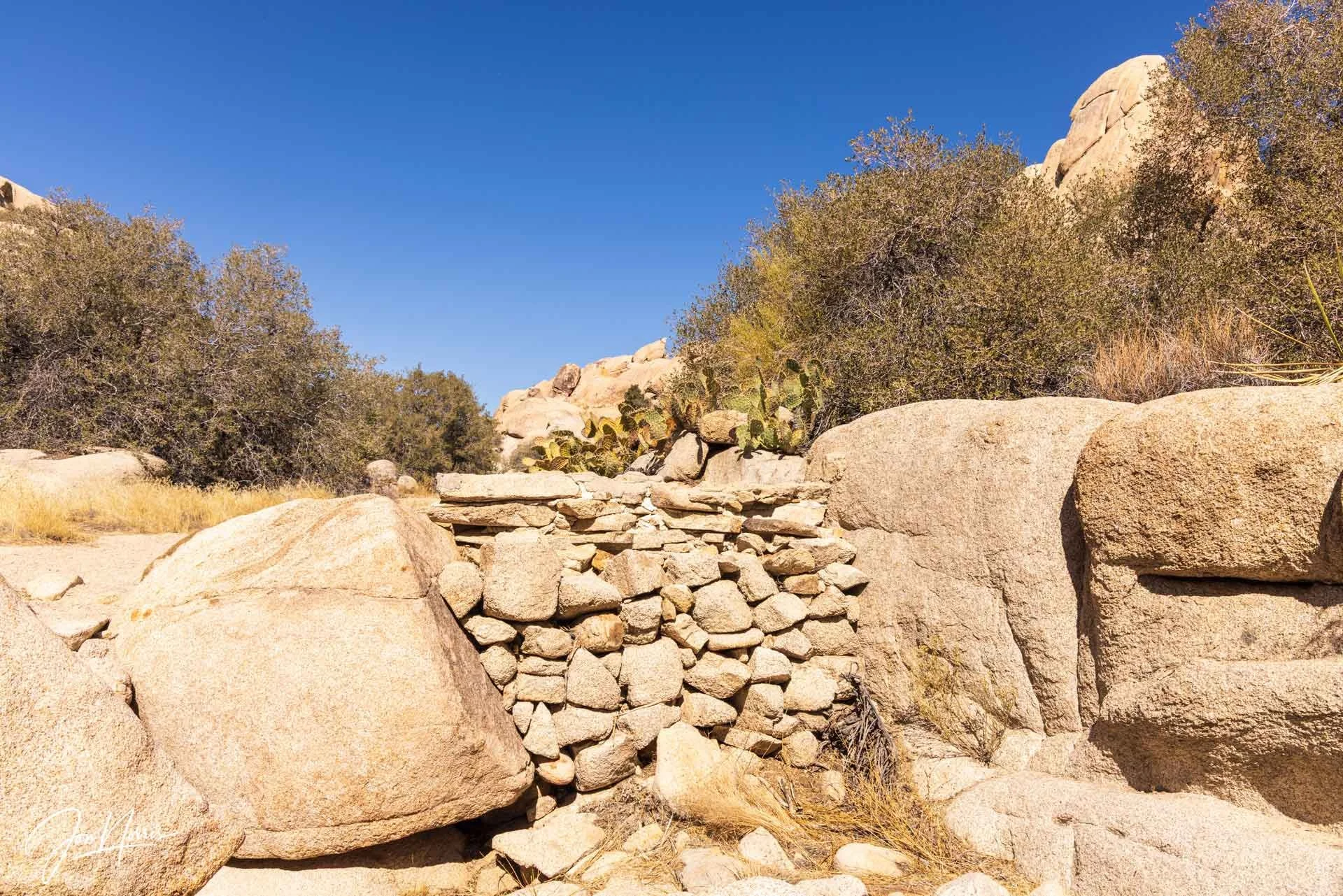
Where’s the dam water? | © 2025 Jon Norris
As I walked up the wash, the trail was quite apparent, and one of the first features I came across was a small dam constructed many years ago to try and preserve any precious water that collected there. Now, the basin that was once behind the stone dam is completely filled with sand, and I doubt it has seen any water for a very long time.
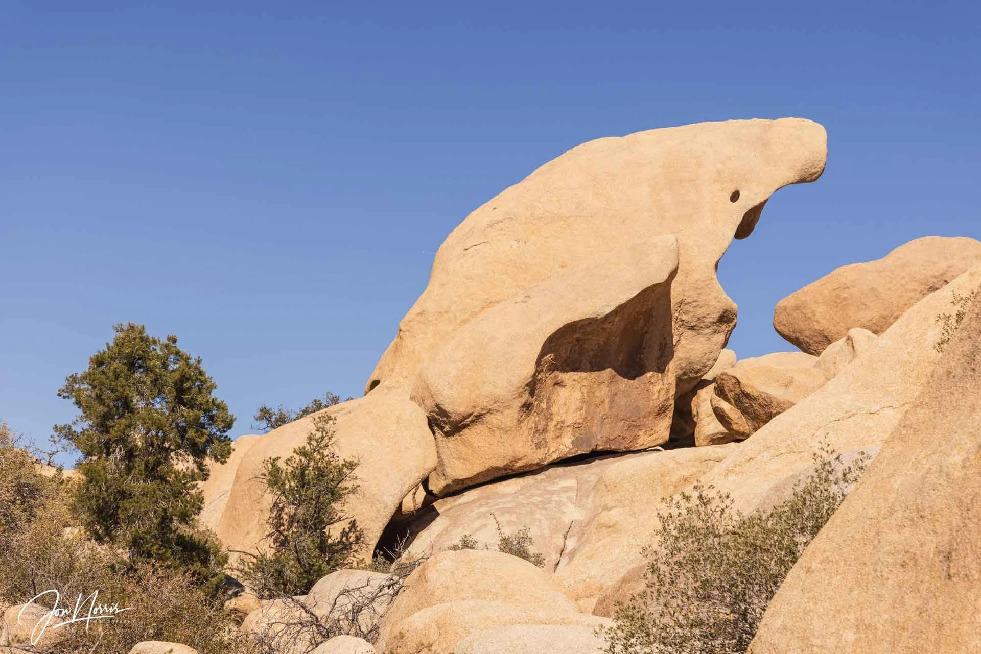
The Walrus or The Creature | © 2025 Jon Norris
The scenery within the Wonderland of Rocks is amazing, with many oddly-shaped quartz monzonite rocks everywhere you look. Post-hike I discovered many of the names of the rock formations. I passed the Walrus, which curiously is called the Creature when viewed from the opposite direction.
After a while, when you’re away from something readily identifiable, all the rock formations and branching canyons on both sides of the wash begin to look similar and it’s very easy to get lost.
It became clear to me very quickly that, as there was no defined trail, I would need to navigate topographically, i.e. using the rock features and inselbergs shown on my map to determine which direction to head.
I use Gaia GPS on my phone as my primary means of navigation (with a paper topo map and compass as backup in my pack), so I was leaving a digital breadcrumb trail as I hiked. I was not going to become a Joshua Tree National Park Search & Rescue (JOSAR) statistic.
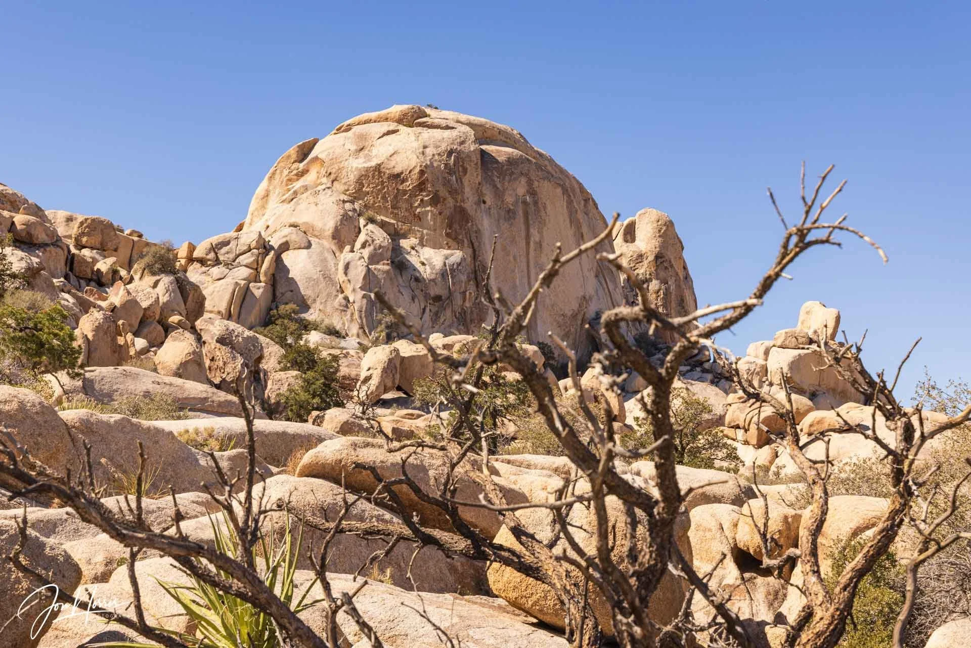
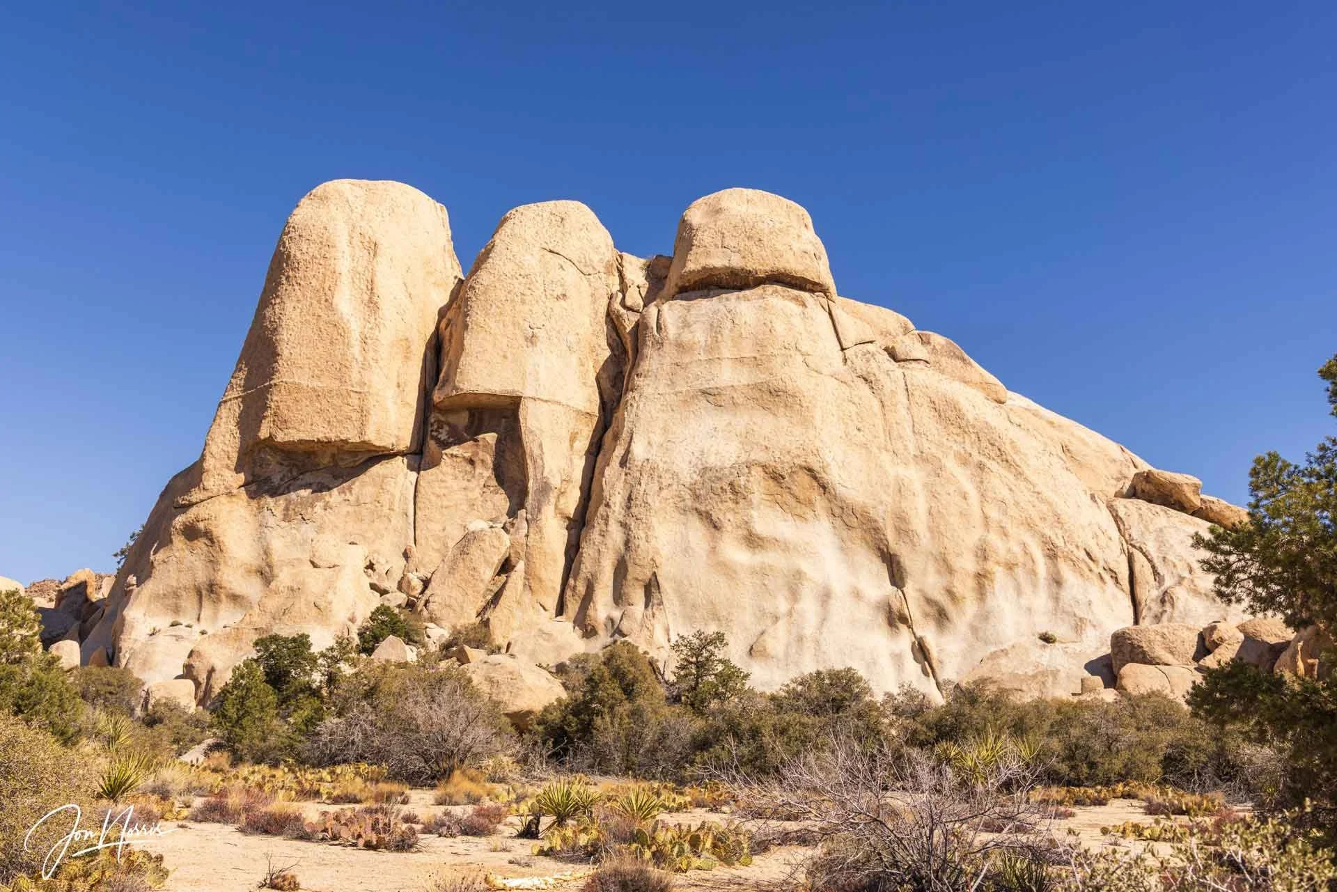
South Astro Dome | © 2025 Jon Norris
A little further on, I came upon South Astro Dome, an enormous chunk of rock that commands your attention as soon as you see it. Many climbers who hike into the Wonderland of Rocks probably don’t go much further than here. There are many climbs around here, such as Foolproof Tower, Punk Rock, and the Freak Brothers.
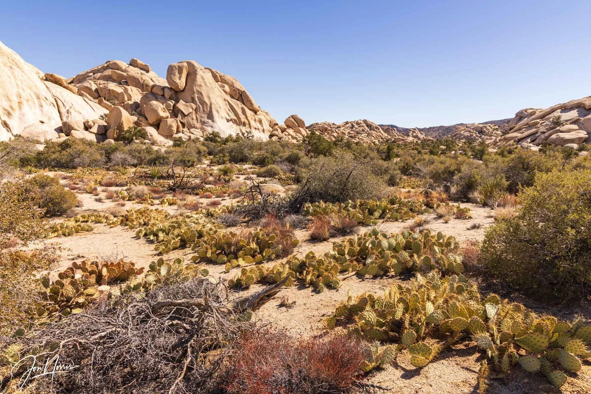
A thriving cornucopia of monzonite, creosote bushes, and cacti | © 2025 Jon Norris
As I’m hiking, I like to pause regularly, turn around, and see where I’ve been. This serves two purposes: a) it’s gratifying to see what you’ve already accomplished on your hike so far, and b) it helps to have an image of what the return path looks like when it comes time to head home.
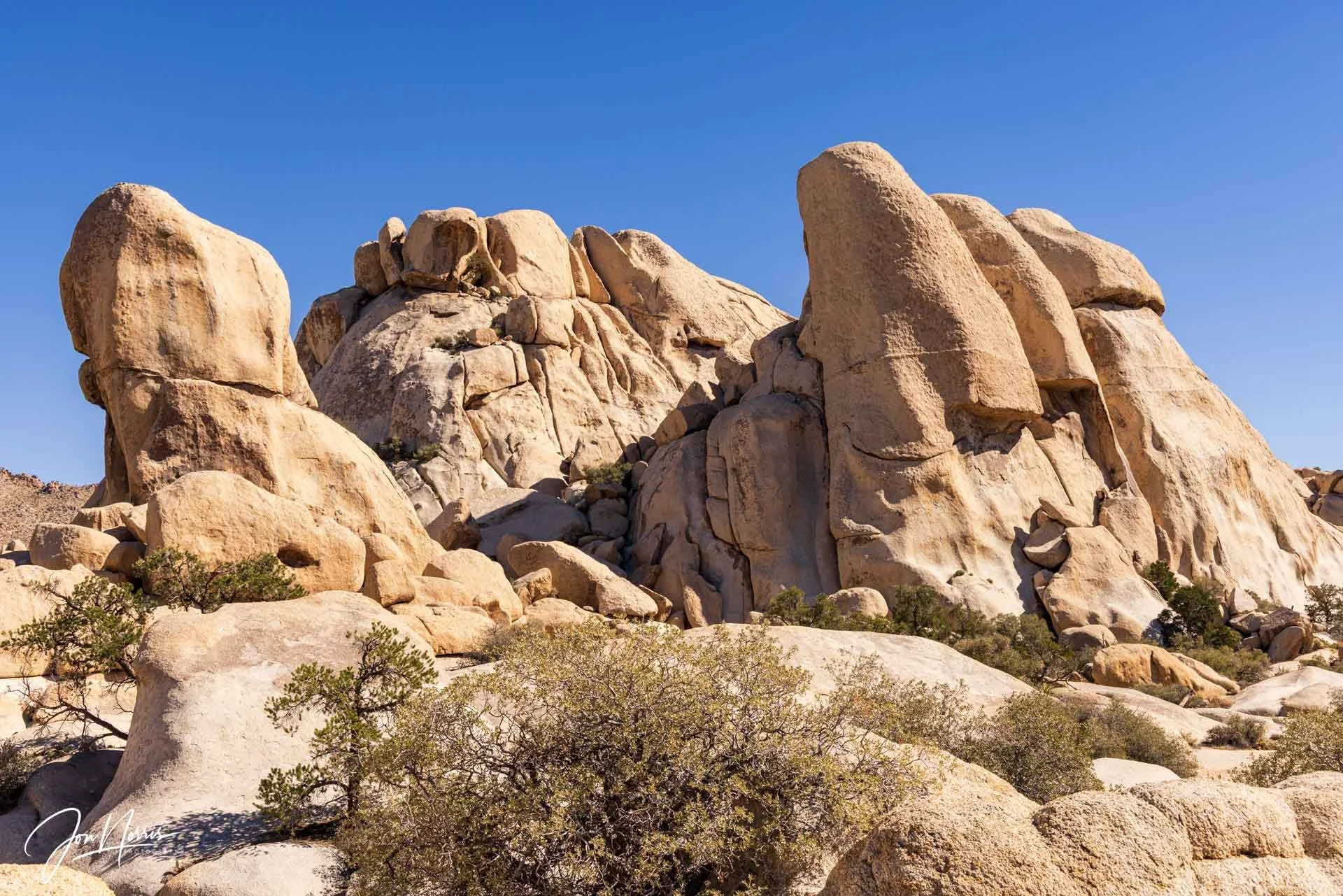
The Freak Brothers | © 2025 Jon Norris
Since leaving Wonderland Ranch, I’d been hiking roughly NNW and had covered about 1.5 miles. A prominent navigation marker for me was reaching the Freak Brothers, where I needed to turn East to continue my quest to find Garrett’s Arch.
(L to R) The Weenie, Fat Freddie’s Cat, and the Freak Brothers | © 2025 Jon Norris
As I rounded the corner, I got a great view of this collection of rock formations: The Weenie, Fat Freddie’s Cat, and the Freak Brothers. Typically it’s the climber who first leads a pitch that gets to name the route. I love the creativity that goes into these names.
The Red Obelisk | © 2025 Jon Norris
From the corner I could see my next landmark, the aptly named Red Obelisk. I’m assuming that the desert varnish on the obelisk contributed to its name. Passing the Red Obelisk, the canyon opened into a vast desert meadow, which I picked my way across carefully to avoid all of the yucca and cacti awaiting me.
I was heading towards a jumbled collection of very large inselbergs (aka rock piles) but so far had not seen any evidence of an arch.
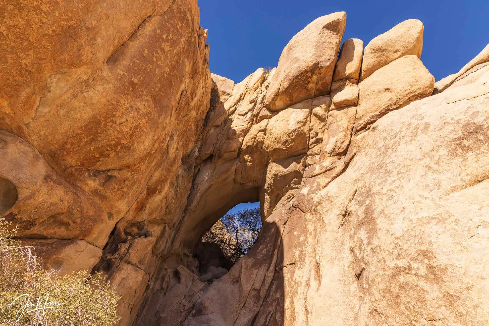
Garrett’s Arch | © 2025 Jon Norris
I headed towards the largest inselberg, rounded a corner, and there it was, Garrett’s Arch, deep in the Wonderland of Rocks. It’s assumed to be the largest arch in the park (meaning no one’s found a larger one as yet), and was discovered by NPS park ranger Gary Garrett.
The arch is about 100 feet above the canyon floor. I scrambled up the diagonal crack that runs toward it to get a closer look, stopping when I reached a large, flat ledge. I’m not as agile as I once was, and I was not going to risk going any higher unroped.
The silhouette of what looks to be a pinyon pine almost wholly filled the arch from where I was sitting.
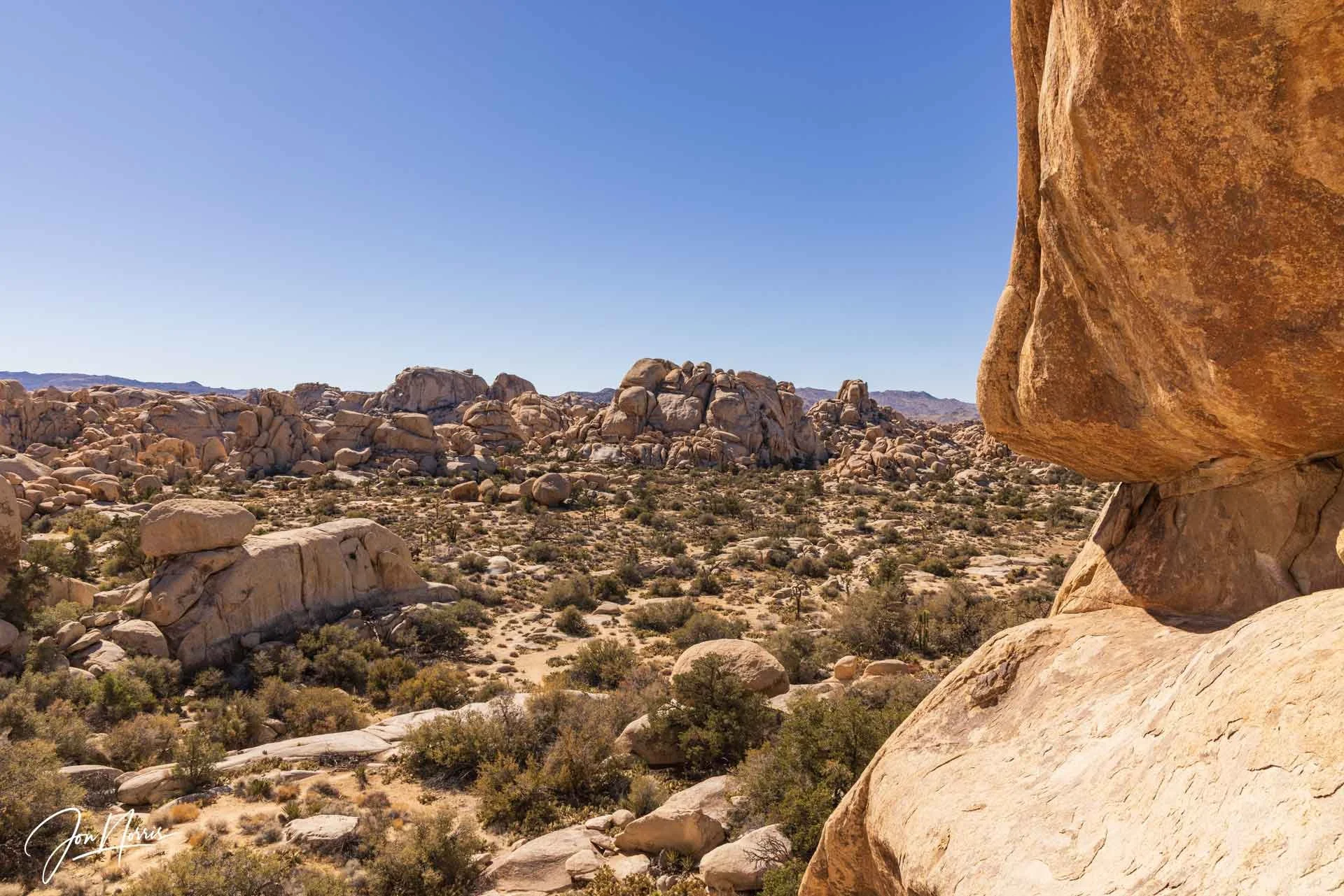
The view from Garrett’s Arch | © 2025 Jon Norris
I spent about 30 minutes just enjoying the view across the Wonderland of Rocks from my lofty vantage point. It’s such a privilege to explore wilderness places such as this. I had this incredible vista entirely to myself. The silence was deafening. I ate a celebratory cereal bar and had a good slug of water and electrolytes.
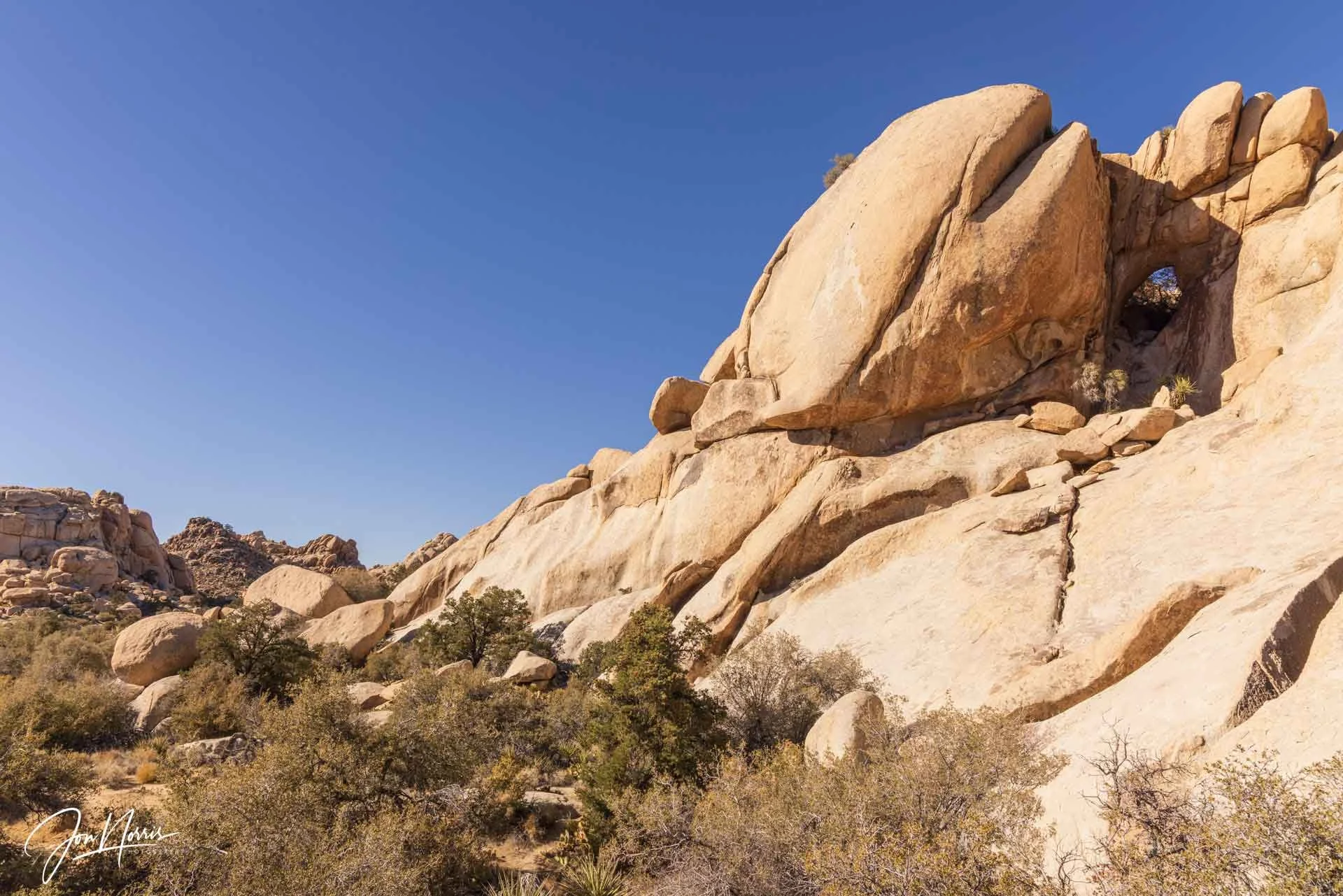
Garrett’s Arch from the canyon floor | © 2025 Jon Norris
After enjoying the view, it was time to descend from my rocky ledge back to the canyon floor. I was so pleased to have reached my goal. I had found Garrett’s Arch!
I then spent about 1.5 hours trying to find a way through the back of the canyon to the Wall Street Mill, so that I wouldn’t have to backtrack my route. Navigating the maze of interlocking canyons was close to impossible. The scrambling was getting more complicated, with cacti, creosote, and cat claw grabbing me from all directions.
I could feel that I was getting tired so I sat myself down and gave myself a good talking to. Why are you doing this? What happens if you get hurt while scrambling?
I had a digital breadcrumb trail so why not use it?
Once discretion had kicked in (i.e. ‘the better part of valor’) I backtracked to Garrett’s Arch and familiar ground.
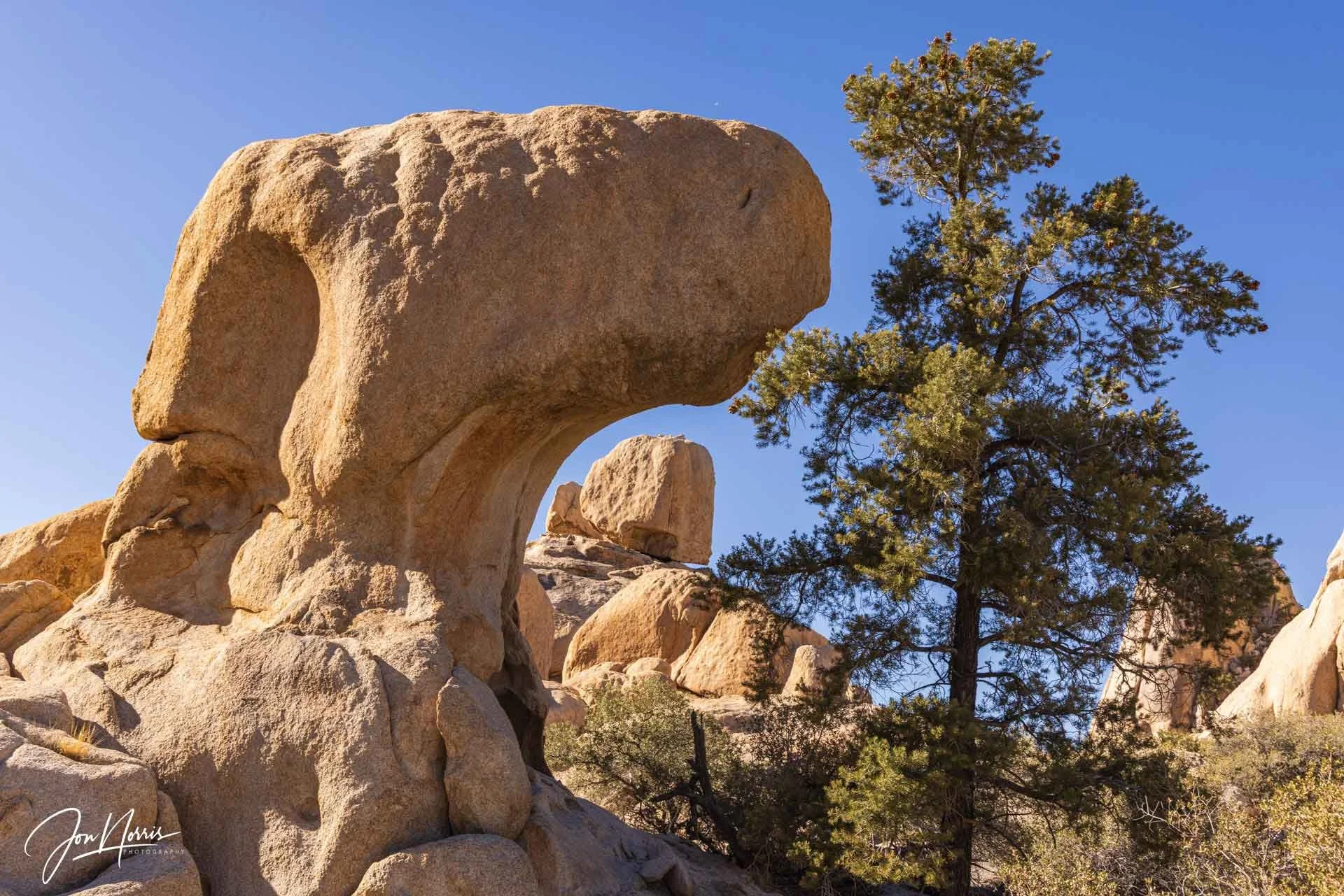
Amazing granite rock formations on the trek back | © 2025 Jon Norris
While hiking back towards the Freak Brothers corner, I passed a whole bunch of fantastic granite rock formations that I hadn’t seen on the way in. It just shows how different a route can look from one direction to the other.
Back at Wonderland Ranch | © 2025 Jon Norris
As I exited the wash and returned to Wonderlend Ranch, I felt relieved and exhilarated. This was the first time I’d explored the Wonderland of Rocks and found Garrett’s Arch. I’d pushed myself physically, been challenged navigationally, had a little emotional wobble, but returned safely.
Late afternoon sun on the trail back to Echo T | © 2025 Jon Norris
Now I just had to get myself back to the truck at Echo T. It was a relief to be able to follow the easy compact dirt and sandy wash trails that took me around Barker Dam and then cross-country behind Snickers to come out close to the trailhead by Echo Rock.
My 5-mile easy photo hike had become a 9-mile hiking and scrambling adventure, but I felt all the better for it. I looked forward to a hot meal and an open fire at the campsite that evening.
Another wonderful (or is that wanderful?) day out in Joshua Tree National Park in the bag.