Hiking the Mastodon Peak and Mine Loop
Explore Landscapes #84
Mastodon Peak is a moderate three mile loop with 375 feet of elevation gain, with great views of the southern portion of Joshua Tree National Park.
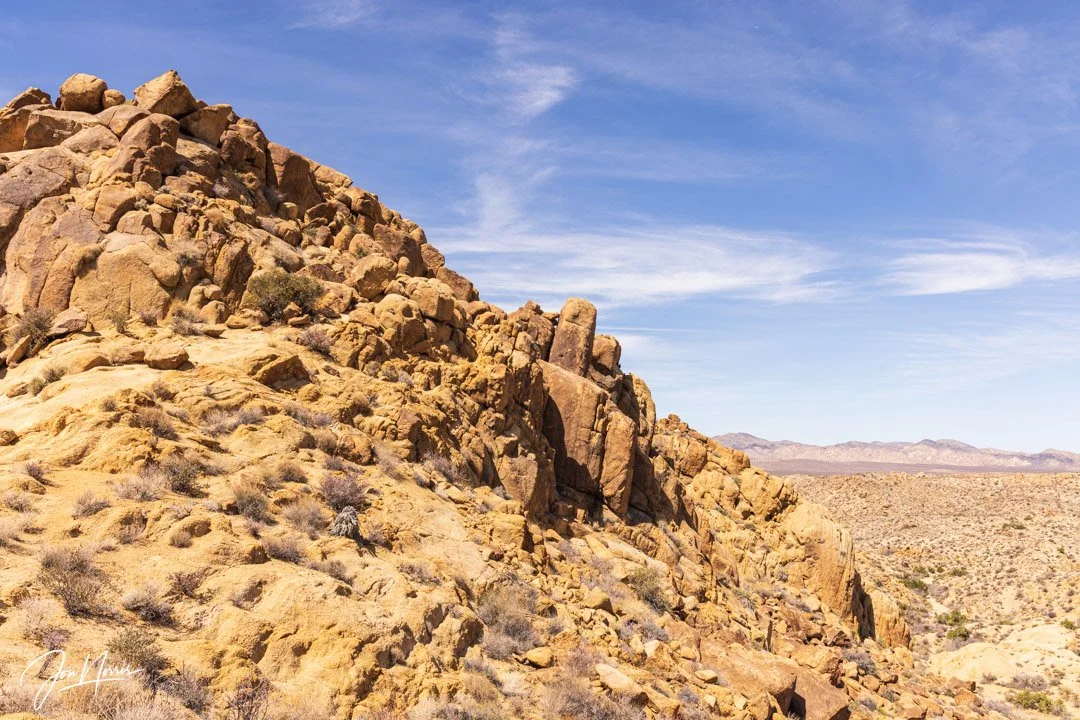
Mastodon Peak and behind that Pinto Mountain and Basin | © 2025 Jon Norris
This was one of the first hikes that I did after starting as a volunteer for the Joshua Tree National Park Association’s Desert Institute back in December 2021 - and I’ve wanted to revisit the hike ever since.
Finally, more than three years later, during a 3-day weekend in March full of hiking, exploring, and leading a sunrise workshop, I got my wish.
If you’d like to read about the other two hikes I completed that weekend, click on the links below:
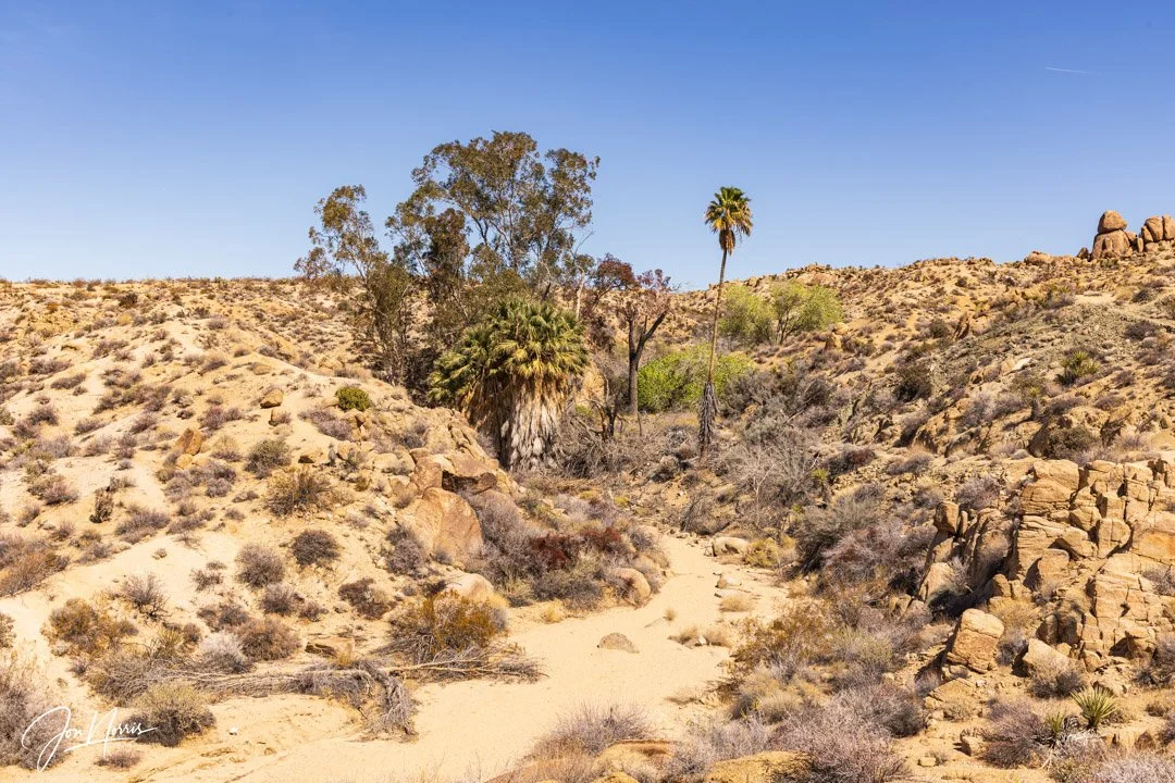
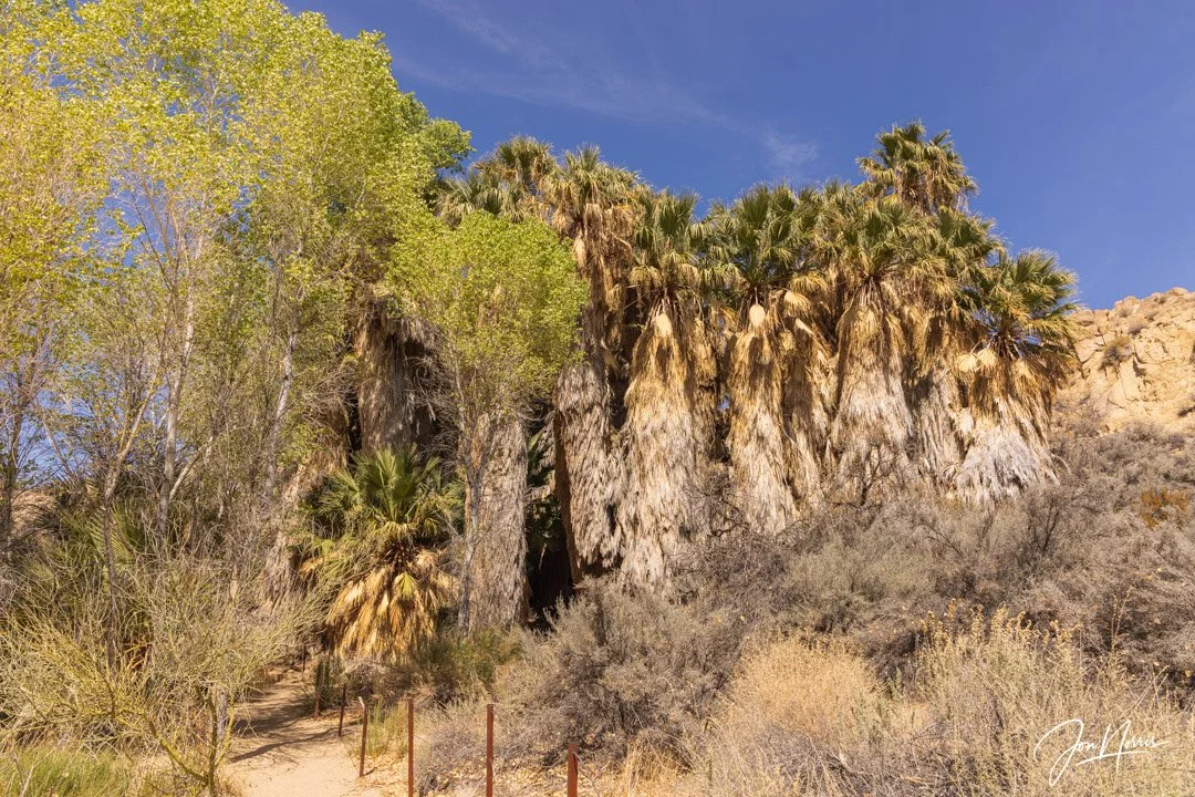
Eucalyptus Trees and California Fan Palms near the Cottonwood Visitor Center | © 2025 Jon Norris
I parked at the Cottonwood Visitor Center, and then followed the trail to the the Cottonwood Spring Oasis parking lot. Rather than follow the Lost Palms Oasis Trail, I opted to take the trail that heads up to the Mastodon Mine before continuing to the Peak itself.
March is just about the perfect time of year to hike in the SoCal desert. For the full weekend I had a bluebird sky (i.e. no clouds), with temperatures in the range of 60-65°F (15-18°C).
The nights were cold, with temperatures down to about 35°F (2°C), but I’d come well prepared as I was camping.
Mastodon Mine Trail | © 2025 Jon Norris
One of the benefits of hiking in the Southern part of the park, which is located in the Colorado desert (part of the larger Sonoran Desert), is that there are significantly fewer visitors. This means that oftentimes you’ll have the trail to yourself. I enjoy and welcome the solitude that this provides, and will search it out whenever I can.
Looking back towards the Pinto Basin and Pinto Mountain | © 2025 Jon Norris
After a fairly short climb - on a well maintained trail - I arrived at the remains of the Mastodon Mine. Mining in the desert was a challenging proposition due in large oart to the hear, scarce water, and lack of wood for building supplies. Despite these significant challenges, many hardy souls took on the challenge. Mastodon Mine is one of approximately 300 mines that were developed within the present-day boundary of Joshua Tree National Park.
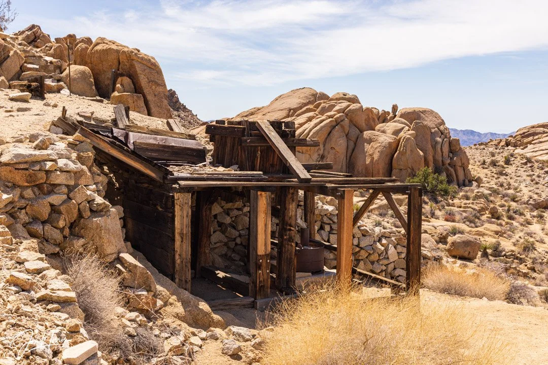
Mastodon Mine | © 2025 Jon Norris
Records indicate the mine was established in the 1930s and worked on and off by the Hulsey family for decades. Originally, the ore was assayed at $744 a ton. However, faulting (the San Andreas fault is less than 10 miles away) had severed the main vein, and it could not be relocated. Like many of the area mines, Mastodon Mine never lived up to the dream of ‘striking it rich.’
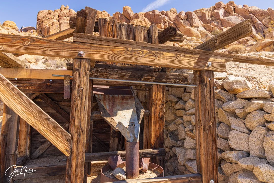
Mastodon Mine | © 2025 Jon Norris
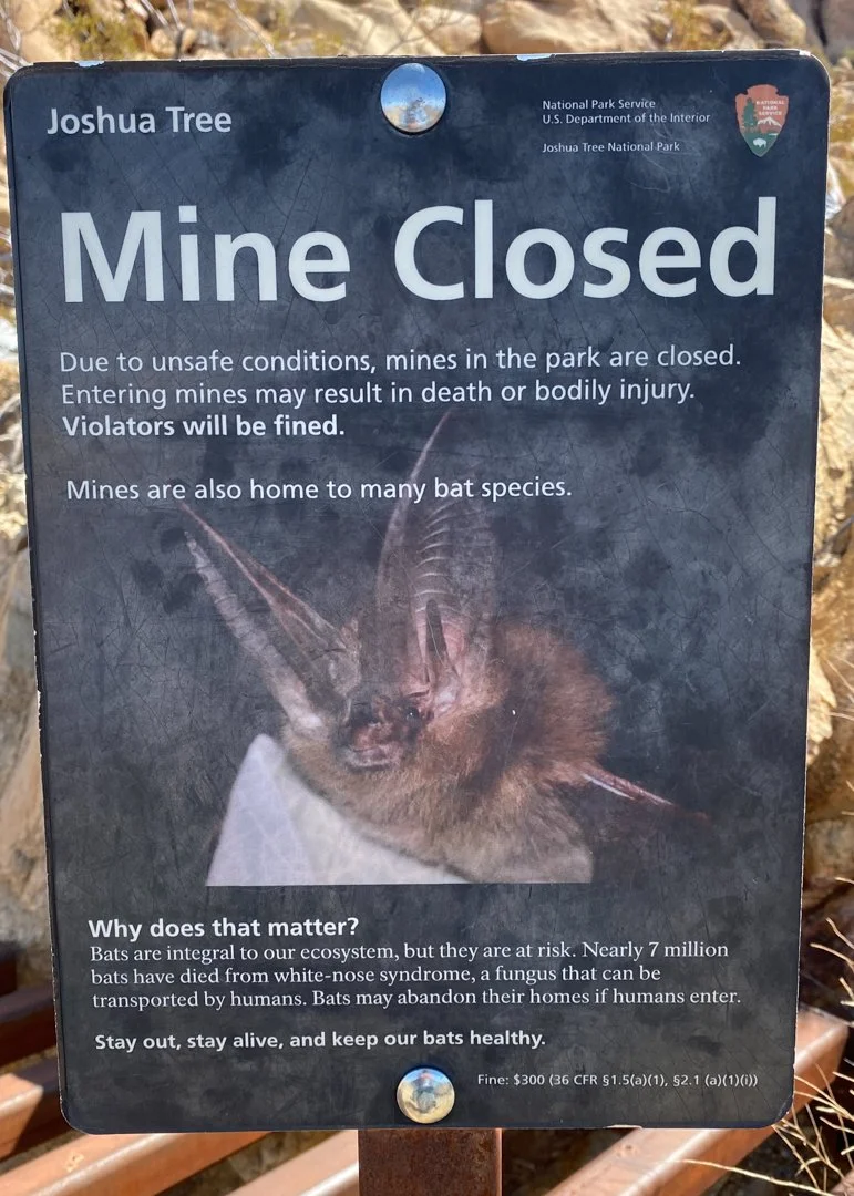
The main shaft of the mine is still visible and you can look down into the darkness below, but has a heavy steel grid over it to prevent entry and/or accident.
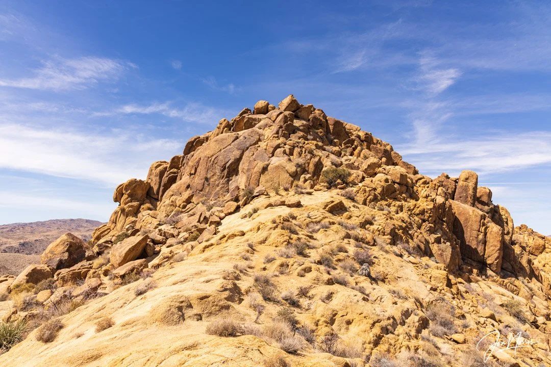
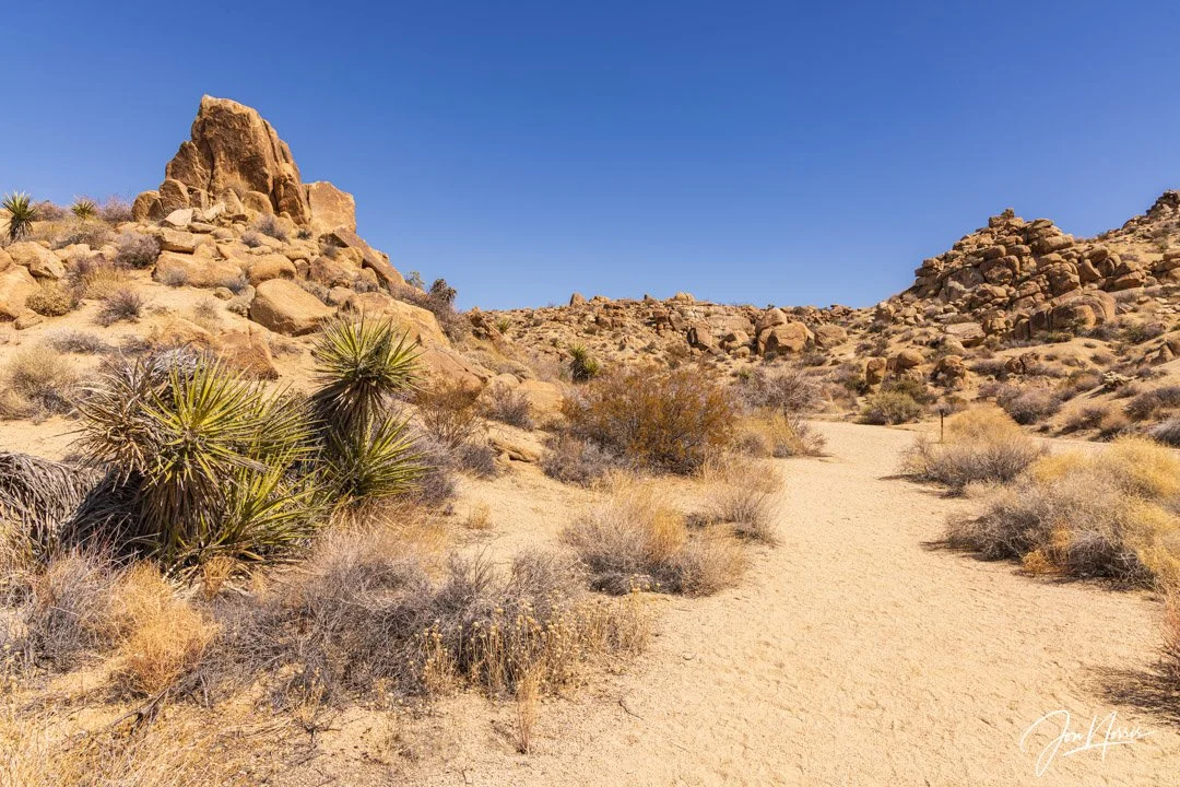
Mastodon Peak | © 2025 Jon Norris
After leaving the mine you have a short hike up to a saddle below the peak, and then an optional scramble up to the top of the craggy granite peak.
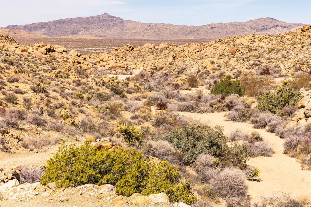
This hike provides great views of the southern portion of the park and also of the Salton Sea. The Salton Sea is a shallow, landlocked, highly saline lake in Riverside and Imperial counties in Southern California. It lies on the San Andreas Fault within the Salton Trough, which stretches to the Gulf of California in Mexico. The lake is about 15 by 35 miles (24 by 56 km) at its widest and longest.
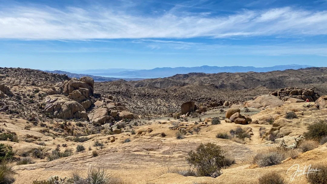
The view to the South which includes the Salton Sea | © 2025 Jon Norris
When I completed the hike back in March there were no wildflowers to be seen except for the occasional flash of red of the flowers atop some of the Octotillo.

Flowering Ocotillo | © 2025 Jon Norris
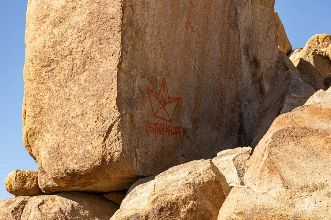
Split Rock vandalism | © 2021 Jon Norris
When I first hiked this loop (back in December 2021) I was so annoyed to see that someone had vandalized the landscape by spraying their ‘tag’ on to one face of a huge split rock.
After my hike I reported the graffiti using Joshua Tree’s dedicated reporting email (jotr_graffiti@nps.gov), sending some images, and providing the GPS coordinates of it’s location.
I sincerely hope that the NPS tracked down and prosecuted the vandal who decided to blight this magical and unique landscape.
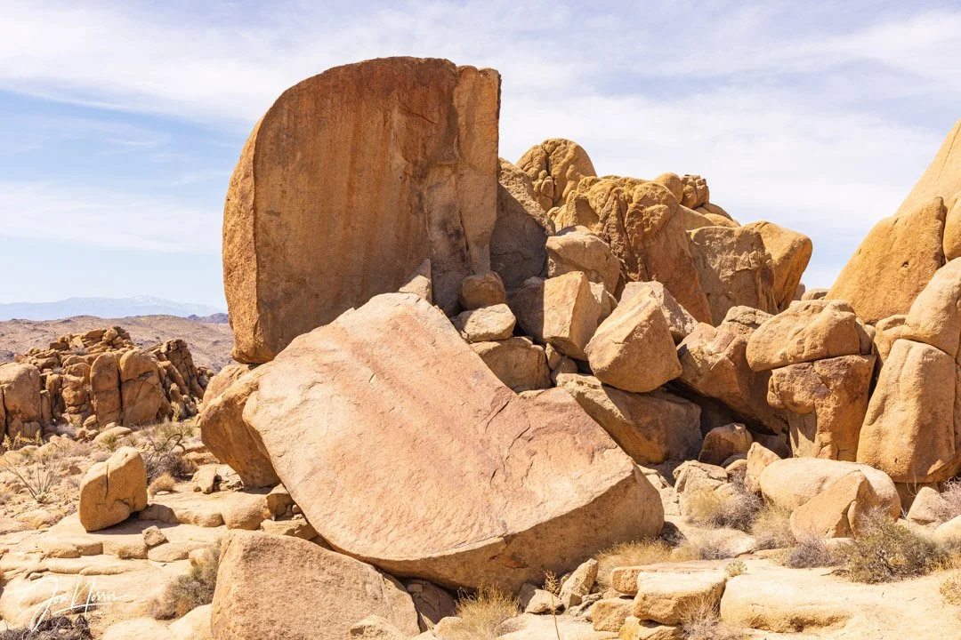
Split Rock with graffiti removed | © 2025 Jon Norris
I was delighted to see that there was no sign of the graffiti when I returned to repeat the hike. The NPS clean-up team did a great job of removing all traces of it.
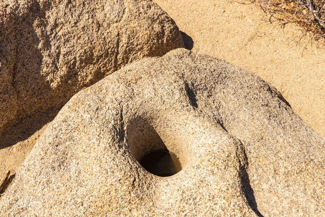
Cahuilla Indian Bedrock Mortar | © 2025 Jon Norris
Shortly after passing by the split rock, I found the Lost Palms Oasis trail, and started my way back to the Cottonwood Oasis.
Shortly before reaching the Cottonwood Oasis there are two large pieces of granite bedrock. Both rocks contain deep mortar holes created over time as Cahuilla Indians pounded mesquite ad other seeds into flour. Judging by the depth of these mortar holes, many generations of Cahuilla women must have spent weeks here every year ensuring that their family and community has food to last them through the year.
The Cottonwood Oasis | © 2025 Jon Norris
It was great to repeat the hiking loop again and I’m planing to go back again soon as I think the split rock location will make for a great subject for some dark sky photography.