Essential Landscape Photography Apps
Explore Landscapes #54
Today I'm sharing my 3 essential (and favorite) apps that I use before/during pretty much every landscape photography shoot.
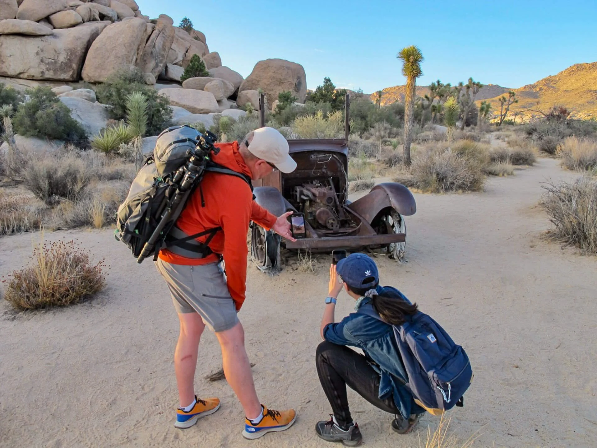
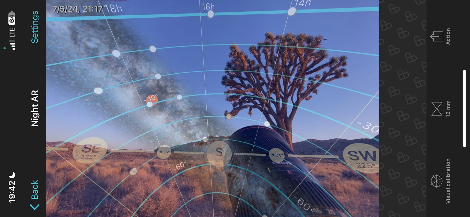
Showing Kay how to use PhotoPills Night AR view to determine where star trails will appear behind this 1929 Lincoln later that night | © 2023 Stephanie Norris
We all have tens (maybe even hundreds) of very useful apps on our phones that we use for all manner of things. As they say, ‘There’s an app for that!’
I have three apps that I consider essential to my landscape photography practice. I typically use them both during my planning and pre-visualization of a shoot and while I’m shooting images.
My essential apps are:
PhotoPills is a photography planning app that assists with many different landscape photography subjects, including the Milky Way, Moon, Sunrise, Sunset, Star Trails, Meteor Showers, Solar Eclipse, Lunar Eclipse, and Time Lapse.
GAIA GPS is digital mapping, route creation, and recording software with maps for every type of adventure.
Astropheric provides advanced weather tools for professional astronomers and astrophotographers in the Continental US and Canada.
All 3 apps are available for both Apple iOS and Android smartphones. GAIA GPS and Astropheric have web-based (browser) versions of their apps, making them powerful tools for planning on a larger screen at home.
GAIA GPS and PhotoPills also have the advantage of working offline. However, with GAIA GPS, you do need to download maps for offline use before heading off-grid.
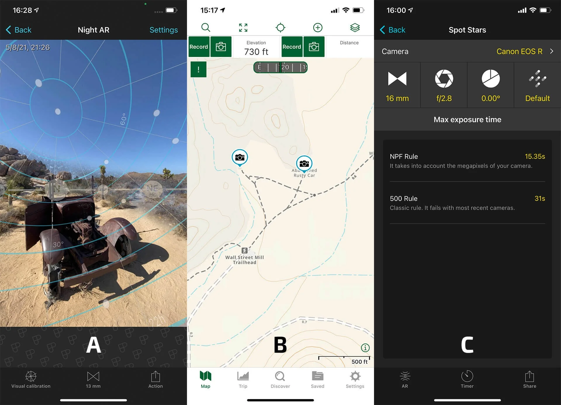
(A) Locating Polaris and pre-visualizing my composition with PhotoPills | (B) Dropping a pin on my GAIA GPS map so I could find my way back to the location in the dark | (C) Dialing in the correct camera settings to ensure sharp spot stars with PhotoPills
I should point out that there are many other apps that perform similar functions to the three I’ve highlighted, but I’ve used these apps for a good few years and rate them highly for what I need them to do. I’m not endorsed or sponsored by any of the app providers. But they’re on my essentials list.
One of PhotoPills' most useful tools for Dark Sky Photography is Night AR (Night Augmented Reality). Planning and pre-visualizing your star trail shot during the daytime is essential unless you enjoy stumbling around in the dark, trying to find foreground elements, and then lining them up with Polaris (see linked post for more info).
When scouting potential photo locations (not just for star trails but also for Milky Way images), I always take Night AR screenshots and drop a location pin in GAIA GPS. You may think you'll remember these locations, but if your memory is like mine, you may not.
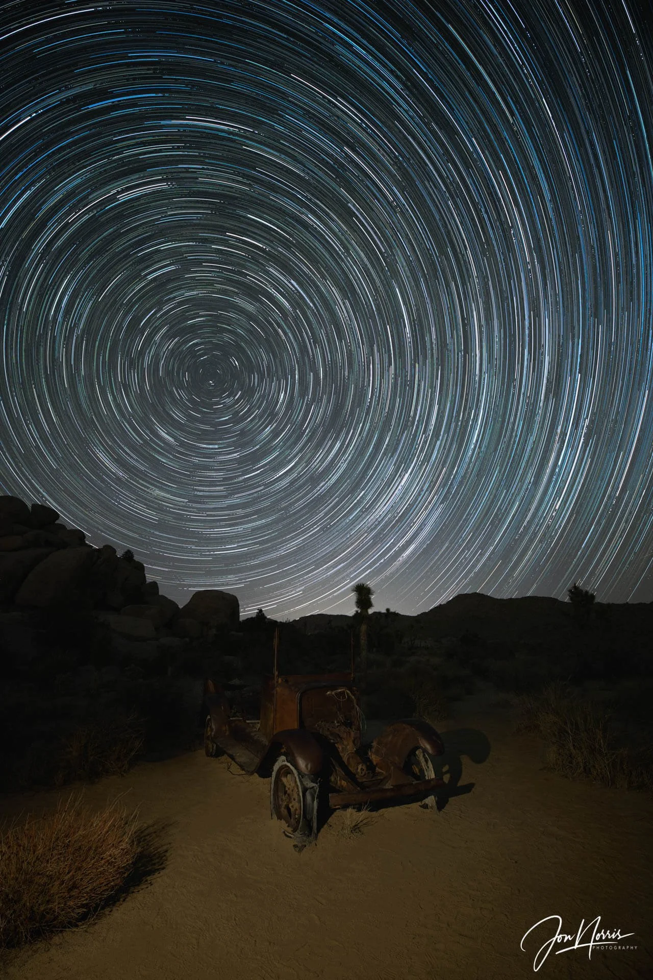
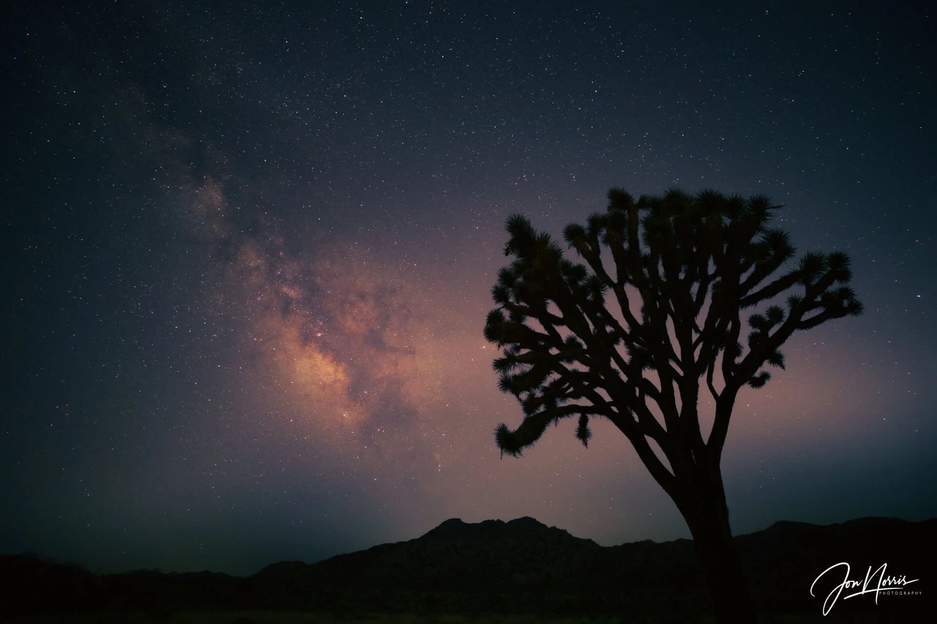
Abandoned and Alone [Canon EOS R, 16-35mm at 16mm | FG: ISO 400, 4s at f/8 | ST: ISO 3200, 15s at f/2.8 190 image stack] | © 2024 Jon Norris
For my star trail images, I like to ensure that the stars are well-focused spots rather than softer, slightly stretched 'blobs' as the stars grow tails due to the Earth's rotation. To ensure this, it’s important that you select the correct shutter speed for your camera/lens combo to ensure spot stars in your images.
The easiest way to select the appropriate shutter speed is to use PhotoPills. Navigate to the Spot Stars section, choose your camera model, which in my case is the Canon EOS R (which sets the sensor resolution), and then select the focal length and aperture of the lens you're using. Under max exposure time, you'll see two different shutter speed values given: NPF Rule and 500 Rule. I typically use a shutter speed close to the NPF rule and faster than the 500 Rule value, resulting in the sharpest stars.
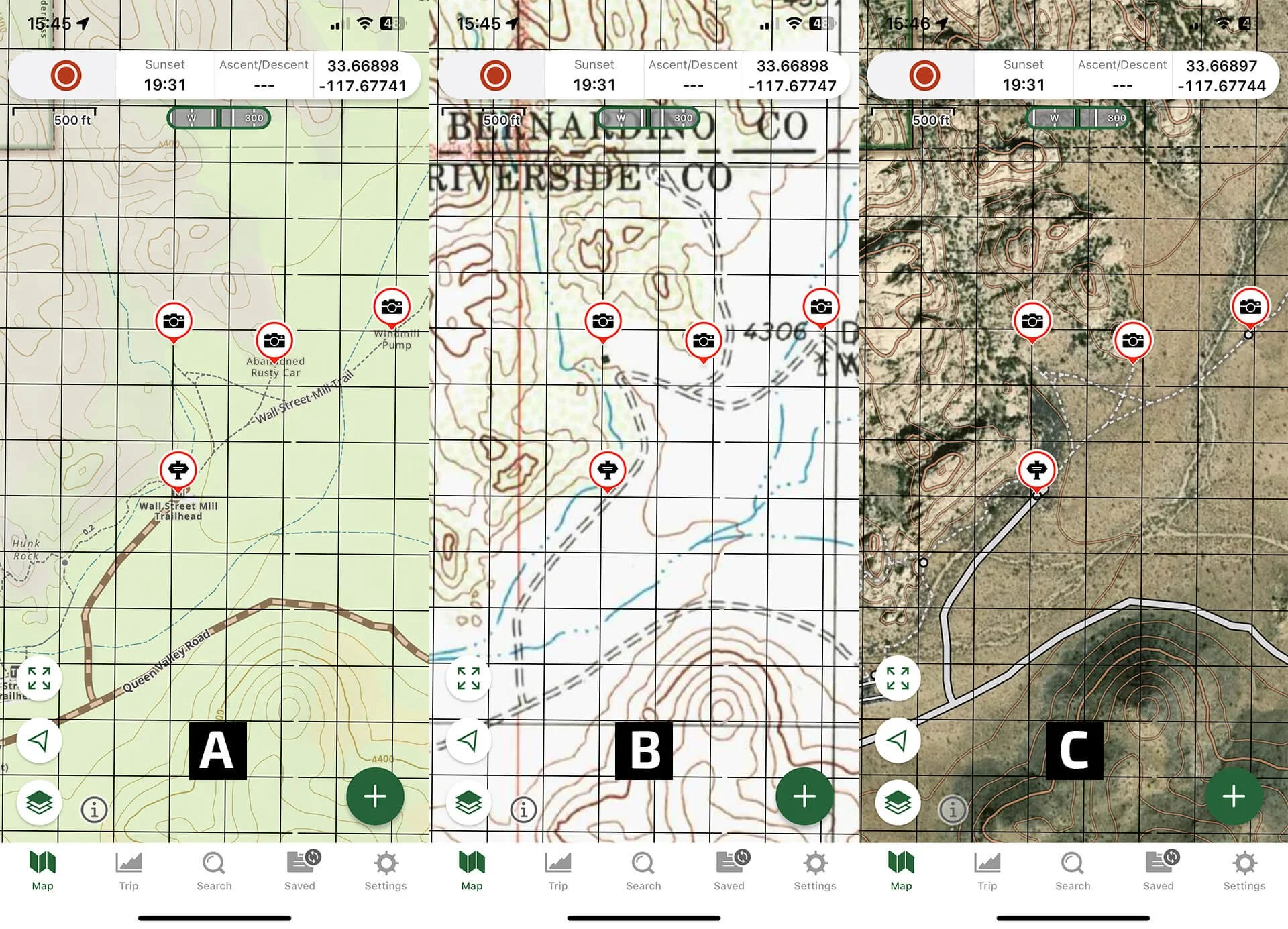
(A) GAIA Overland | (B) USGS Topo | (C) Satellite Topo map layers
I use GAIA GPS as my map and navigation app for all of my hiking, backpacking, and photography scouting trips. I keep a record of all my tracks and also use it extensively to record waypoints as I scout to come back to later.
GAIA GPS features many map layers (if you opt for the premium license - which I would highly recommend). This allows you to fully customize the map as you want to see it.
I’ve found the most useful layers (for my landscape photography) to be Gaia Topo, Satellite Topo, Gaia Overland, USGS Topo, Public Land (US), and Light Pollution.
When I save maps for offline use, I save those 6 layers so that I can choose which to use in the field to suit what I’m doing and where I am.
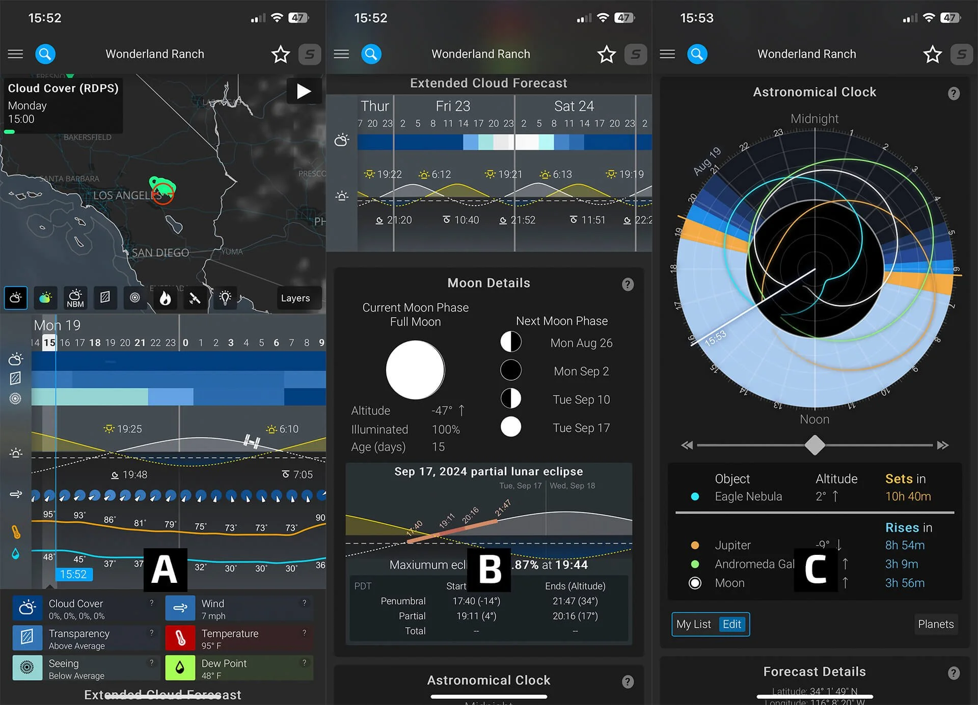
(A) Astropheric map, cloud cover, transparency, seeing, wind, temperature, and dew point | (B) Extended cloud forecast, moon details, and eclipse | (C) Astronomical clock and celestial objects
Like many photographers, I’ve tried various weather apps with varying success levels over the years. As I shoot a lot of dark sky photography, two of the most important weather items for me are the amount of cloud cover and the sky's transparency.
For several years, I used the app Dark Sky. However, Apple purchased it some time ago, and its functionality was brought into Apple’s native weather app.
Since then, I’ve been using Astropheric and am very happy with its performance. I typically only use the first page of the forecast (which shows the map, cloud cover, transparency, seeing, etc.). One of its strengths is that it averages four different cloud cover models - which I’ve found to be fairly accurate.
However, please remember that Astropheric does not work offline. If you want to see the forecasts in the field, you’ll need to take screenshots, but of course, these will not be up to date.
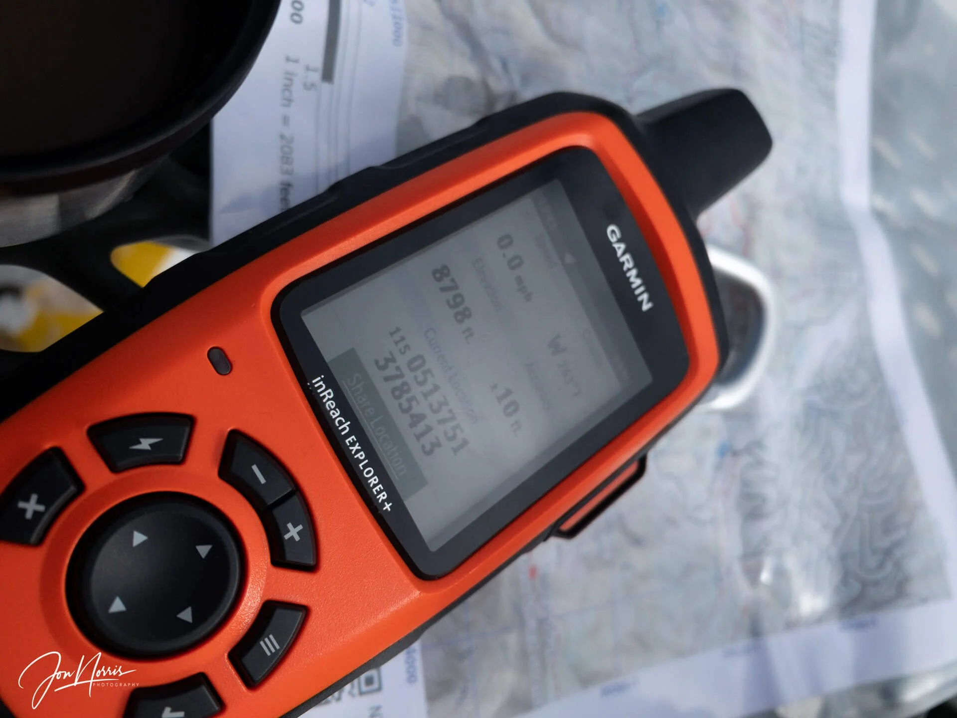
My trusty inReach EXPLORER+ GPS and PLB | © 2024 Jon Norris
For that reason, to get up-to-date weather forecasts while I’m in the field, I rely on my trusty inReach EXPLORER+, which can receive detailed weather reports for my specific location over GPS.
Verifying my composition in PhotoPills before sitting down and waiting 90 minutes for the night sky to arrive
The edited final image of the composition forecast by PhotoPills | © 2024 Jon Norris
I’ve only scratched the surface of what these apps can do to support your photography and time out in the wilderness. I encourage you to do your homework, try out a few apps, and see what they can do to save you time and/or improve your photography.
For example, PhotoPills provides an excellent interface to help you understand and calculate the depth of field and hyperfocal distance when out in the field. See the linked article for more info.
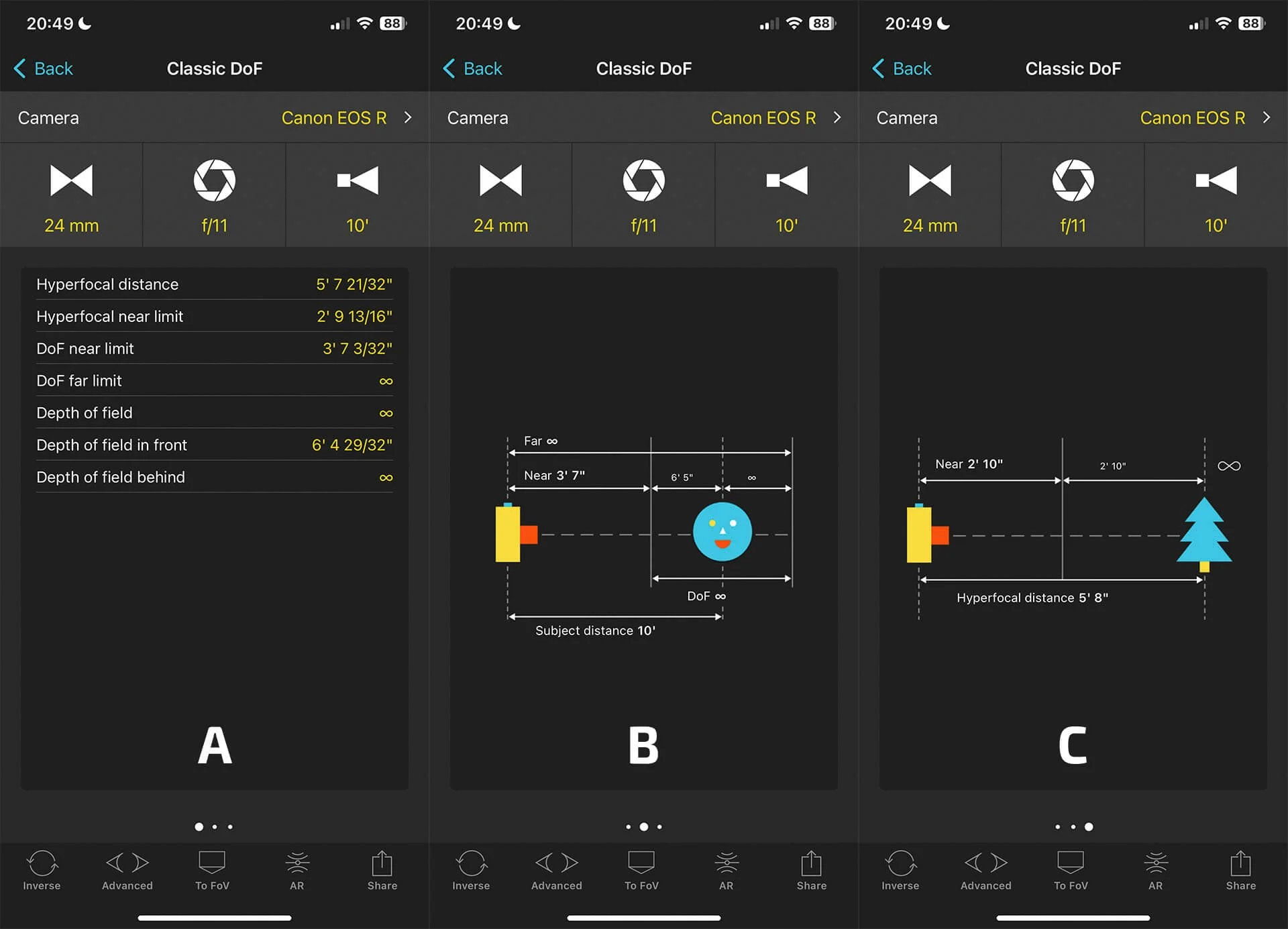
PhotoPills Depth of Field Info Pages | © PhotoPills
I’d love to know what apps you use to support your photography. Please do drop me a line if you think I’m missing a trick, or if you’ve found the next best app!