A Desert Hike
Explore Landscapes #9
October and November are probably my two favorite months for hiking in the SoCal desert. The temperature is typically in the mid 70's, there's a light breeze, and a blue sky.
Yesterday’s hike fits right into that categorization - perfect weather and conditions. I’m leading two photo hikes for the JTNPA Desert Institute on the first Friday in November and December, and yesterday’s hike was a scouting expedition for the November hike.
I followed a route I’d scoped out before, which features a good selection of Joshua Tree National Park(JTNP) historical artifacts and the beautiful desert scenery. The route is a 5-mile figure of eight that only gains 160 feet in elevation during the entire hike.
Starting off from the Echo T trailhead, the hike heads toward one of the many granite inselbergs typical of the Hidden Valley and Wonderland of Rocks areas of JTNP. As you follow the sandy trail that winds between creosote bushes and yuccas (avoiding the occasional cholla cactus - don’t touch!), the next section of the trail reveals itself. The track turns to the left and zig-zags its way up a granite staircase of large rounded boulders towards the Barker Dam trail.
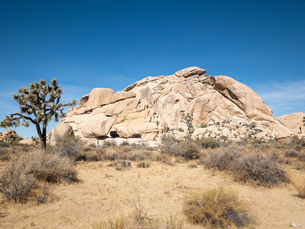
Echo T is a popular rock climbing location within Joshua Tree National Park
As I walk up the granite staircase, I notice that, on this visit, I’m not greeted by flowering prickly pear cacti showing off their red, orange, or yellow flowers. I’ll have to come back in the spring to see them.
The large open area of the desert between the granite staircase and Barker Dam is full of all manner of desert shrubs and wildflowers, with pinyon pines and scrub oaks tenaciously occupying the deep, dark cracks in the granite where they’ve found their home.
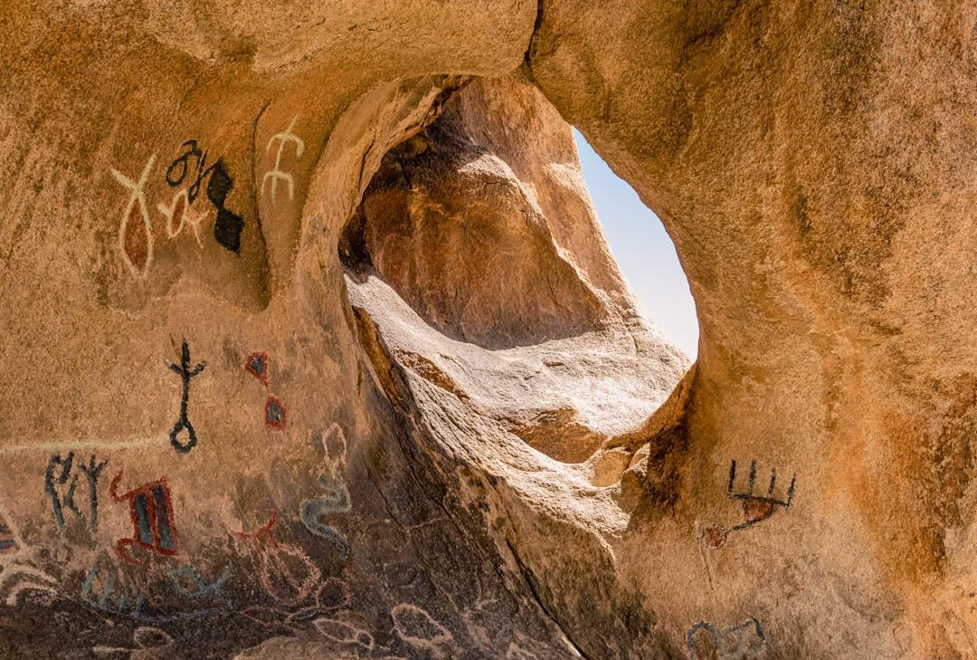
The Barker Dam Petroglyph Cave includes petroglyphs (images carved in rock)… …and pictographs (images painted with mineral paints)
As the trail levels out, I quickly come upon the Barker Dam petroglyph cave - sadly, it was defaced back in 1961 by a Disney film crew who wanted the colors to pop, so they painted over the originals.
Next, the trail follows the tail-end of the Barker Dam loop back to the trailhead - but I’ll be back to see the Dam later.
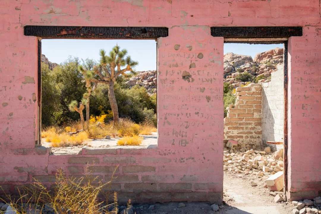
Wonderland Ranch (also known as the Ohlson House after the last owners)
The short trail from the Barker Dam trailhead to the Wall Street Mill trailhead leads onto my first port of call in the South Wonderland of Rocks area, Wonderland Ranch. This must have been an impressive building in its heyday, but since being destroyed by fire sometime in the late 70s / early 80s, only a few walls remain standing - which are painted a bright pink color.
This is a great area for photos that juxtapose the remaining walls of the ranch with the surrounding Joshua Trees and granite rock piles. This is one of my favorite areas for photo workshops - both during the daytime and also for dark sky photography.
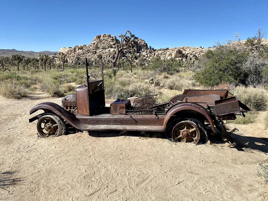
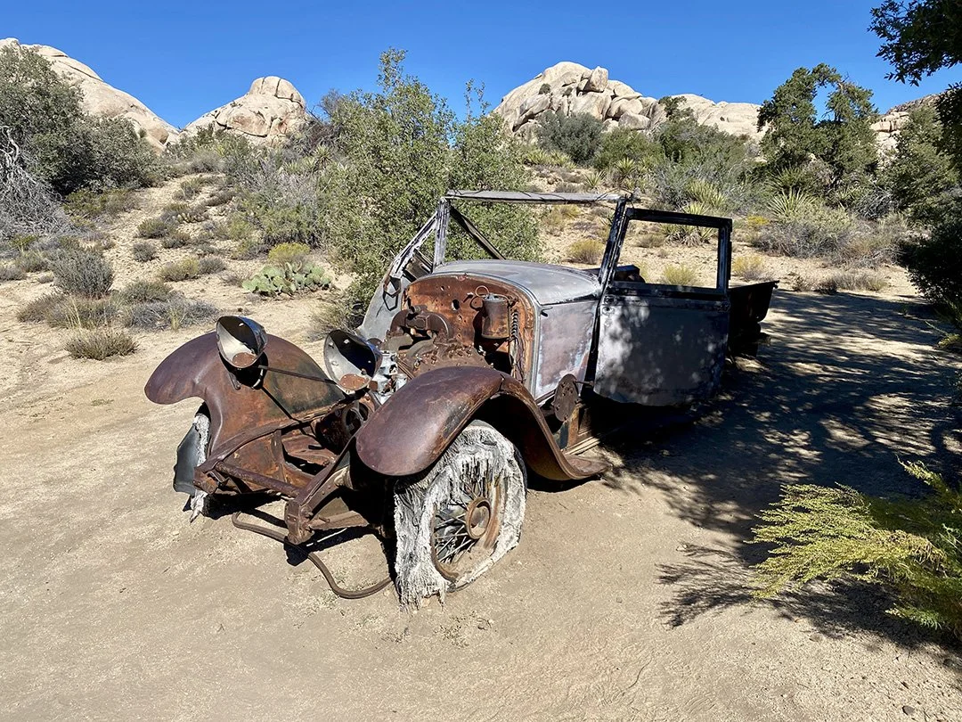
Car #1
A short hike from the ranch, I come across the first automobile we’ll see. This (I believe) is a 1929 Lincoln - a passenger vehicle that had been locally converted to a pick-up truck and, by the looks of it, led a hard life until it stopped moving and stayed where it stopped.
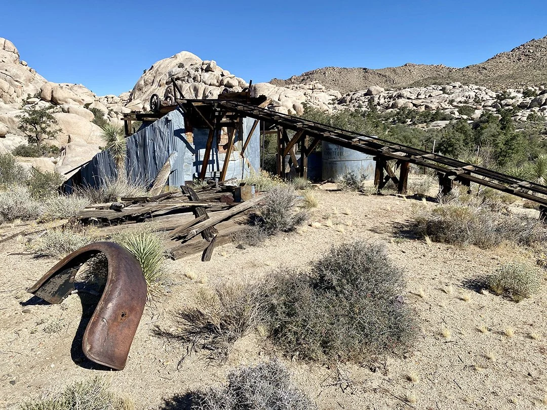
Wall Street Mill
Heading cross country for about a mile, I come upon the Wall Street Mill. This stamp mill was operated sporadically (by Bill Keys - his name will come up a few more times along this hike) between 1930 and 1966 and was used to crush the mined ore to expose the gold or silver it contained.
I can’t help but imagine what it must have felt like to work at the mill during the scorching summers of old. Steam-driven cast iron stamps pounding the ore to crush it; mercury and arsenic being used to lift the gold or silver particles from the slurry. It must have been a tough life for anyone involved with this mill.
Car #2
I continue around the back of the mill and into the wash that forms the start of the trail back to the trailhead. There’s a second old-timer sitting in the wash and slowly returning to the desert as it disintegrates. Continuing on, and with the mill on my right, there’s a thicket of trees and shrubs that are so dense you cannot see from the outside what they contain.
I had visited the mill multiple times before I found the remains of the little green automobile that has its final resting place in the thicket.
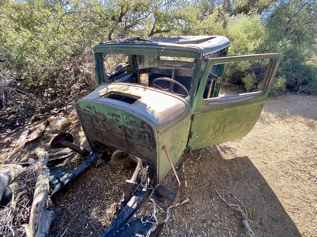
Car #3
Eventually, the trees and shrubs will envelop the little truck completely and subsume it into their growth.
At this point, I’m about halfway, so I take a short break to rehydrate (not forgetting to add electrolytes to my water) and have a snack. Food always tastes so much better when you’re out in nature - even the humble Peanut Butter Clif bar I have.
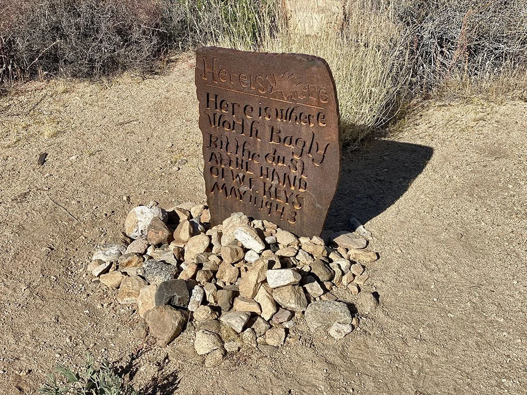
Worth Bagley Stone (sadly a replica as the original stone was vandalized and broken in 2014)
A few hundred yards later, I come across the Worth Bagley Stone, inscribed with: “Here is where Worth Bagly bit the dust at the hand of W. F. Keys May 11 1943.
On that day in 1943, Bill Keys (who was one of Joshua Tree’s most famous (and successful) settlers, was ambushed by Worth Bagley. Bagley shot at Keys first and missed; Keys was a better shot and killed Bagley outright. They had been in dispute about access across each other’s land for years to gain access to the Wall Street Mill and the Desert Queen Well.
Keys turned himself in to the local sheriff, and as no one could verify what happened, it was assumed that Keys was not acting in self-defense. Keys was convicted of manslaughter and started his sentence at San Quentin State Prison. Keys was later paroled and then pardoned from the crime through the efforts of Erle Stanley Gardner - author of the Perry Mason novels).
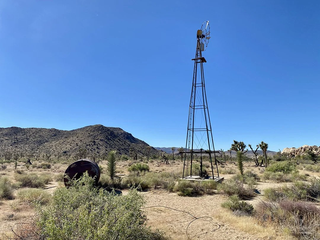
Windmill and Water Tank
I then walked back towards the Wall Street Mill trailhead and came across another of my favorite locations for dark sky photography - the windmill at the former Desert Queen Well site.
William Morgan developed the well (some 120 feet deep) between 1905 and 1908 to service the Desert Queen Mine. Morgan hoped to build a mill on the same site, but that never happened. In 1917 the site came into Bill Key’s possession, then in 1924, it was managed by the Southern Pacific Land Company, who then sold it to Worth Bagley. See how the same names keep popping up on this hike.
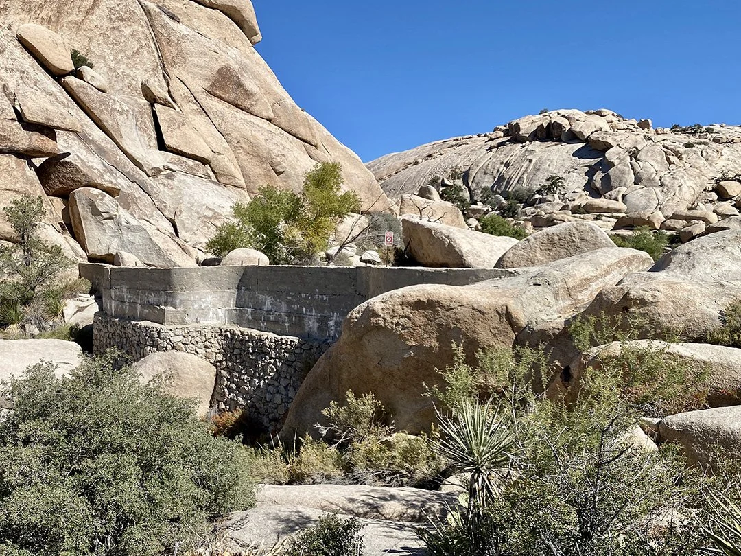
Barker Dam
After another mile or so, I come to Barker Dam. What was originally a natural tank (a catch basin for rainfall and runoff) was expanded into a dam by the Barker & Shay Cattle Company. Later, it was enlarged again by Bill Keys (yes, him again). On this visit, there was no water in the dam - but the water will return after a good rain, and sometimes you can see water birds here.
Rather than follow the main Barker Dam trail back to the trailhead, I follow a fainter trail out into what appears to be the open desert. After half a mile, the trail meanders toward the granite boulders and inselbergs behind Echo T, then rounds the corner and heads straight back to the trailhead parking lot.
I’m happy - it’s been a wonderful hike, and I can’t wait to lead the upcoming photo hikes for the JTNPA Desert Institute. That hike takes place on Friday, November 3rd, and you can learn more and book a place on the hike here.
If you can’t make that date but would like to come on the same photo hike, you can also book the hike via my website - and there are multiple dates to choose from.
Until next time, explore, experience, and enjoy our wildlands responsibly. Think before you geotag. Adopt the 7 Principles of Leave No Trace and practice Responsible Nature Photography.
Bye for now,
Jon